Falmouth Field Trip 2014-
This website reflects the opinions of students and not the views of the University of Southampton or the National Oceanography Centre.
Produced by: Alice Duff, Philippa Fitch, Joanna Gordon, William Harris, Thomas Jefferson,
Eirian Kettle, Jesse Marshall, Dominique Mole, Emma-


Aim
To determine the physical structures offshore and how it impacts the chemistry and biology, while comparing this with the overall structure in the Fal estuary.
Objectives
To identify the physical structures present offshore, specifically at Lizard Point.
Determine how the different physical structures present between the offshore and estuarine stations impact their chemical and biological characteristics.
Determine how the physical characteristics of the water column are affected by the local conditions present.
Introduction
Offshore regions are areas of significant horizontal gradients in ocean properties. Estuaries are transition zones and therefore more varied in chemical, physical and biological features compared with offshore regions. Regions of large horizontal changes in temperature, salinity and density are common in coastal areas and estuaries. There are many types of fronts but the main ones located in coastal regions are upwelling fronts, shelf break fronts, shallow sea fronts and estuarine fronts. Temperature of water masses plays the most important role in the formation of fronts and is also key in identifying the location of the front along with changes in salinity and density. To locate and map the features and size of the front, CTD profiles and transects will be vital (Fearnhead, 1975).
Methods
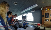
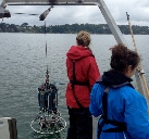
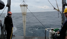
Weather permitting on 30th June 2014, it was decided that we would head as far West as possible to sample on the other side of Lizard Point to identify the physical characteristics of the coastal water and map the features and fronts there. The first station (station 45) was a part of a time series that every group contributed to just outside the mouth of the estuary. At station 45, a CTD profile was carried out to collect the same nutrient samples as in the estuary along with a secchi disc reading and an ADCP profile. Four vertical zooplankton tows were also carried out at stations of sufficient biological interest. After a second CTD profile was carried out (station 46), an ADCP transect was taken while we moved to the next station on the other side of Lizard Point. After the transect, the front was sampled across its width from the well mixed station 47 to the stratified end of the front at station 50 with CTD casts, ADCP profiles and transects carried out as before.
The location of the stations sampled can be seen in Figure 1.
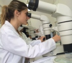
The chemical and biological analysis of the water samples taken were again performed the following day on 1st July 2014 using the methods outlined in the appendix.
See Appendix for further detail.
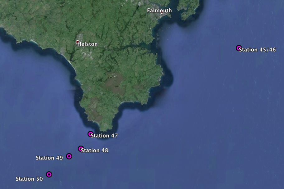
Figure 1 -
Click figure to enlarge
Offshore
| Geophysics |
| References |
| Introduction |
| Physical |
| Chemical |
| Biological |
| References |
| Introduction |
| Results |
| References |
| Introduction |
| Physical |
| Chemical |
| Biological |
| References |