Falmouth Field Trip 2014-
This website reflects the opinions of students and not the views of the University of Southampton or the National Oceanography Centre.
Produced by: Alice Duff, Philippa Fitch, Joanna Gordon, William Harris, Thomas Jefferson,
Eirian Kettle, Jesse Marshall, Dominique Mole, Emma-


Over a two week period (23rd June 2014-
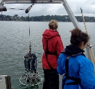
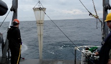
The aim of the study is to compile chemical, physical, biological and geophysical data to aid understanding of the processes occurring in the Fal estuary. This was completed using a range instruments on different platforms including the NOCS’s Callista and Bill Conway vessels and a fixed pontoon. Group 3’s (2014) initial findings are summarised in this website.
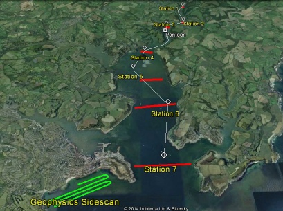
Stations for data collection were selected based on published information about the Fal Estuary and surrounding area, including factors such as the site’s designation as a Special Area of Conservation (SAC), pollution events and known locations of frontal systems.
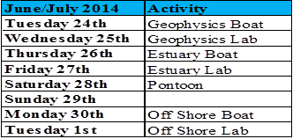
The map on the left shows the Fal estuary and surrounding coastal waters. The positions of each of the locations surveyed and sampled are shown on the map, excluding the offshore stations. The Calendar above shows the schedule used by Group 3.
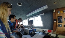
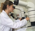
Three research boat excursions and a day of data collection on the King Harry pontoon were undertaken over the course of the two week period. A number of days at on site laboratories were also included in order to analyse the data collected.
| Geophysics |
| References |
| Introduction |
| Physical |
| Chemical |
| Biological |
| References |
| Introduction |
| Results |
| References |
| Introduction |
| Physical |
| Chemical |
| Biological |
| References |