Falmouth Field Trip 2014-
This website reflects the opinions of students and not the views of the University of Southampton or the National Oceanography Centre.
Produced by: Alice Duff, Philippa Fitch, Joanna Gordon, William Harris, Thomas Jefferson,
Eirian Kettle, Jesse Marshall, Dominique Mole, Emma-


Results -
Current speed generally increased at one to two meters depth, and then decreased
downwards, mostly having the lowest speeds at the sea-
Discussion -
Pontoon
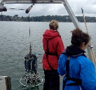
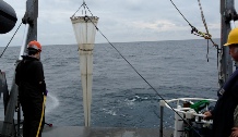
Currents


Temperature
Salinity
pH
Dissolved Oxygen
Turbidity
Chlorophyll
As the tide begins to ebb at 09:00 UTC, the cooler seawater being flushed out of
the estuary was replaced with warmer riverine water. During low tide (11:00-

During high tide there is a greater amount of saline seawater in the estuary. As the tide begins to ebb this saline water is flushed out of the estuary and replaced by less saline riverine water. At low water the lowest salinity reading were recorded, 31.2. At flood tide the denser seawater begins to flow back into the estuary pushing the lighter riverine water up creating stratification at 14:00 to 15:00 UTC

Seawater has a higher acidity due to a higher concentration of dissolved CO2 (Hofmann et al., 2009). During high tide (07:30 to 09:00 UTC) the data reading from the YSI probe show a low pH. As the tide begins to ebb around 09:00 UTC there is a distinct change in pH as the more saline water is flushed out of the estuary and replaced by more alkaline riverine water. As the tide begins to flood, the lighter riverine water floats on top of the denser acidic seawater that is beginning to flow back into the estuary.


The oxygen saturation is linked to the temperature. O2 saturation tends to be higher
when temperature is higher. A relatively low ODO (%) is seen at high tide (07:30-

As the tide ebbs from 09:00 to 12:00 UTC, the water shallows and friction between
the riverbed and the overlying water column increases. This increase in friction
results in an increase in re-
At high tide, the chlorophyll levels were relatively high. As the tide begins to ebb, data shows the chlorophyll levels dropping. This may be due to organisms such as phytoplankton begin flushed out past the sample station with the ebb tide (Trigueros and Orive, 2000). Chlorophyll levels would be expected to return to a higher level, this was not reflected in the data. This could be due to the increase riverine input from a few days of heavy rainfall.

Click to figure enlarge
| Geophysics |
| References |
| Introduction |
| Physical |
| Chemical |
| Biological |
| References |
| Introduction |
| Results |
| References |
| Introduction |
| Physical |
| Chemical |
| Biological |
| References |