The views and opinions expressed in this website are not necessarily those expressed by the National Oceanography Centre or the University of Southampton. The opinions and views expressed are those of the authors of the website

Key Findings
Nitrate
Nitrate concentrations behaved as expected below the thermocline, where plankton concentrations were in abundance and concentrations were depleted. Interestingly, one of the station exhibited a significantly greater concentration of nitrate at a depth of approximately 10m, which could be indicative of increased mixing.
Phosphate
Phosphate as a nutrient is a key variable for primary production, and due to the fact that at all three stations the phosphate concentration decrease between depths of 15m to 25m, this is suggestive of this process.
Silicon
Silicon concentrations were significantly diminished from depths of 5m to 20m, likely due to the uptake of this nutrient by phytoplankton that inhabit the thermocline between these parcels of water. At depths greater than 20m, silicon concentrations exhibited a steady increase for all three stations as expected due to a reduced uptake and increased mixing.
Phytoplankton
The phytoplankton population of the Fal estuary from Mopus Reach to Black Rock was varied in terms of both population composition and number. Station F73 had the highest number of organisms with approximately 675 organisms per ml. All other stations had less than 350 organisms per ml. Both station A69 and G75, the furthest upriver and the closest to the mouth of the estuary, had phytoplankton populations dominated by Tintinnids.
Zooplankton
Both zooplankton populations of station A69 and G75 were dominated by copepods; whereas the middle station, E74 was dominated by hydromedusae. Station G75 had the highest number of organisms with 78 organisms per m3. Station E74 had the lowest number of organisms with only 53 organisms per m3.
ADCP and CDT
The measurements made by both the ADCP and the CTD show the Fal estuary is well-
Met data
Date: 29.06.16
Time Range: 08:45 BST 15:30 BST
Co-
Air Temperature: 14°C
Cloud Cover: 7/8
High Tide: 00:26 BST
13:09 BST
Low Tide: 07:06 BST
9:37 BST
Introduction to Estuary
Estuary data was collected from the Bill Conway, factors investigated included temperature, depth, salinity, chlorophyll and dissolved oxygen at various depths across different sites along the estuary and river. The results of this data collection are displayed in the accompanied tabs. Once data was collected, in was analysed in labs the next day.
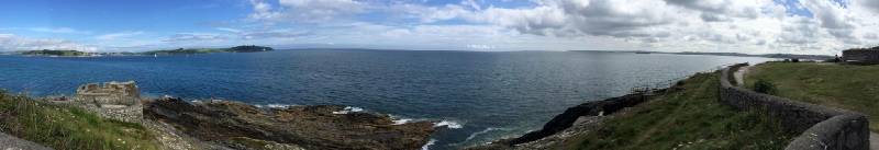
The aim of this survey was to provide an overview of the physical, chemical and biological components of the Fal estuary. There was a specific focus on the changes in these parameters from Mopus Reach to Black Rock.
Aims and Objectives
Estuary data was collected from the Bill Conway, factors investigated included temperature, depth, salinity, chlorophyll and dissolved oxygen at various depths across different sites along the estuary and river. The results of this data collection are displayed in the accompanied tabs. Once data was collected, in was analysed in labs the next day.