Home Offshore Pontoon Geophysics Estuary Researchers

Disclaimer: the views and opinions expressed are those of Group 9 members and not necessarily those of the University of Southampton, National Oceanography Centre or Falmouth Marine School

Falmouth Group 9 
2015
Introduction

A time series survey was conducted on the Fal estuary, at the King Harry Pontoon, on the afternoon of the 26th June 2015. Simultaneous physical and chemical measurements were obtained every half an hour between the hours of 12:00 and 15:00 UTC. The aim was to acquire data over a tidal cycle, resulting in 7 tests. Current speed measurements were done with a current meter and light and dissolved oxygen were measured using an YSI probe in order to relate light and turbidity with the chlorophyll distribution. Water samples were taken with a plastic bottle and then filtered for later chlorophyll concentration determination in the lab.


Metadata

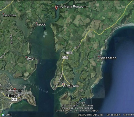
Figure 1: a map showing the position of the King Harry Pontoon in relation to Falmouth Town Centre

Pontoon

Date

Time

Location

Weather

Tide time

Tide height/m

26/06/2015

1200 – 1500 UTC

50° 012.570’N

005° 001.390’W

Between 12:00 and 13:30 UTC was windy with drizzle and cloud cover of 8/8 and after 13:30 the sun came out.

Hightide: 1209 UTC

Low tide: 1841 UTC


4.1


1.8