Link to final habitat map is available here (pdf)
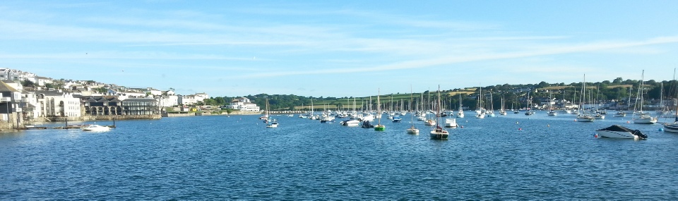
The Fal Estuary, South-west Cornwall, is home to a range of habitats and rich biodiversity. Consequently, it has been designated as a Special Area of Conservation (SAC) by DEFRA [17]. St Mawes harbour has a range of habitats, including maerl and eelgrass beds. The ecological importance of maerl has led to the inclusion of two species (Phymatolithon calcareum and Lithothamnion corallioides) in Annex V of the EC Habitats Directive [18]. Production of recent data on the habitat of Saint Mawes will allow more informative decisions to be made, and therefore aid the control of anthropogenic effects. Small scale habitat mapping is important on a local level for conservation priority setting [19].
Aim: To study the benthic habitat in the Saint Mawes Harbour.
Objective:
To use the side scan sonar to map the seafloor along 4 transects in Saint Mawes Harbour to map benthic habitats.
2. To deploy a video camera to determine species present in the habitat.
A subsurface Dual Frequency side scan was run at 410 kHz and 100 kHz, with a swath of 75m. The side scan was towed behind the MTS Xplorer along the 4 transects at Saint Mawes Habour. Data was collected from the 100 kHz survey and printed onto a paper trace. Surfer 8 software was used to produce a map of the boat track transects. Video imaging of the benthic habitat was carried out along 3 transects. Video was used for species identification, supplementing the side scan data by ground-truthing the bedforms and habitats. Findings were quantified by calculating the approximate percentage cover of each species.
Species present:
Eelgrass, Zostera marina, covering ~ 40-70%. Irish moss, Chondrus crispus, present in large quantities, ~ 30-40% approximate seabed cover. Sea lettuce, Ulva lactuca, and Crypotpleura ramosa, grow in lower concentrations, < 20% approximate cover. Sand occurs in the Eelgrass beds in concentrations up to 100% cover.
Maerl, Phymatolithon calcareum, covering ~ 70-75% approximate seabed cover. Maerl bed communities in St Mawes Bay have Irish moss, Chondrus crispus, and Sea Lace, Chorda filum are present.
Section of bed dominated by both Maerl, Phymatolithon calcareum, and Irish moss, Chondrus crispus, which is a dominant species in Seagrass beds. Showing the area to be a Maerl community.
Discussion:
The results highlight the diversity and richness of the flora and fauna in the St Mawes Harbour, Falmouth. Video imaging evidence shows that the maerl bed communities were either high in maerl coverage, or patchy and less dense. Coarseness of the sidescan sonar allowed speculation of a maerl bed community composed of a mixture of both high, and low density, patchy maerl beds.Scanning at a higher frequency, using grab samples or more video imaging transects are all approaches that could be used to confirm the detailed structure of the maerl bed communities. Gravel and sand communities were assumed only on sidescan sonar evidence, not physical evidence that would have confirmed the structure of the habitat.Video imaging and sonar evidence suggested that eelgrass bed coverage was very extensive. Overall, our study reinforces how imperative the decision was to make the Fal a Special Area of Conservation (SAC), particularly with maerl beds, whose complex structure supports high levels of biodiversity [19]. A wider variety of benthic habitat mapping techniques will be needed for a more detailed map of this section of the Saint Mawes Harbour to be built.