
Estuarine environments are some of the most productive ecosystems on earth; thus, the measurement of physical, chemical and biological properties throughout an estuary is key to understanding the unique ecosystems that it hosts.
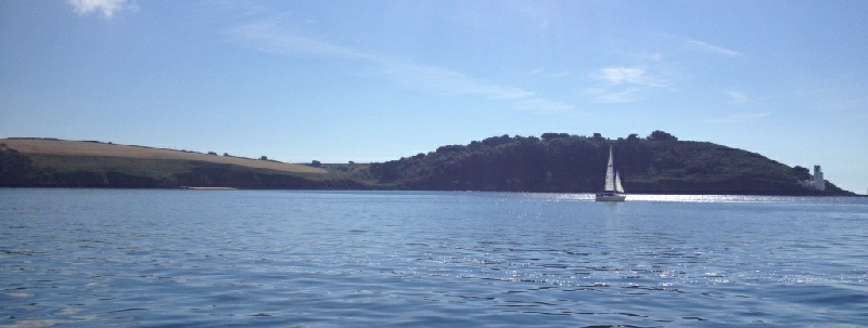
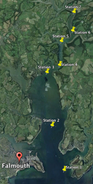
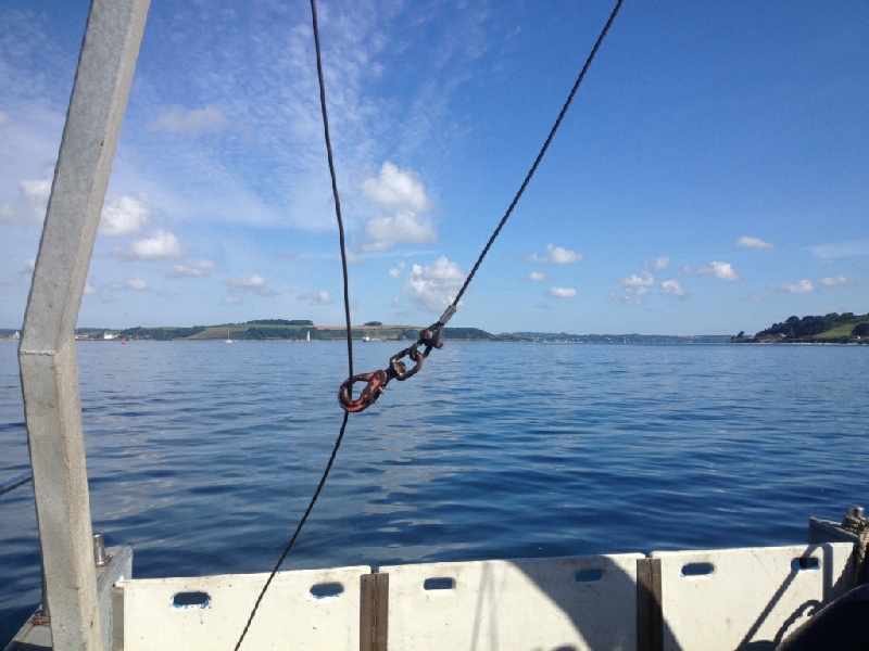
The principal aim of this investigation was to gain an understanding of how the biological, physical and chemical characteristics of the Fal Estuary changed with distance from the Falmouth coast. In order to explore these properties within the estuarine transition zone, Group 6 collected data from 7 sites in the estuary on the 23rd June 2015, from Station 1 (Black Rock: 50°08.607N, 005°01.441W) at the mouth of the estuary, to Station 7 (50°14.392N, 005°00.881W) further upriver (Figure 3.1). These sites were not taken at regular intervals, but were selected to represent the changes within the whole estuary, from a predominantly saline body of water, to one with a greater freshwater input.
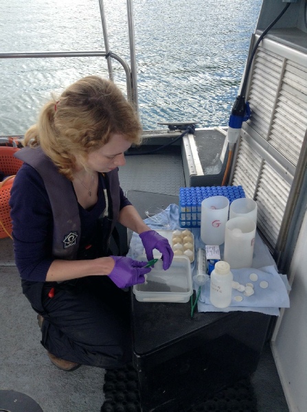
Samples were collected whilst on board the R.V. Bill Conway between 07:47 UTC and 12:13 UTC, on a neap tide (High Tide: 03:38 UTC, Low Tide: 09:20 UTC). Weather conditions were initially sunny; cloud cover increased from 4/8 to 7/8 over the duration of the sampling period. All samples taken were stored correctly and taken to Falmouth Marine School for laboratory analysis on the 24th June 2015.
INTRODUCTION
Flushing Time of the Fal Estuary
stuary
References
Grasshoff, K., Kremling, K., & Ehrhardt, M. (1999). Methods of seawater analysis. 3rd ed. Wiley-VCH.
Johnson, K. & Petty R. L. (1983). Determination of nitrate and nitrite in seawater by flow injection analysis. Limnology and Oceanography, 28, 1260-1266.
Parsons, T. R., Maita ,Y., & Lalli, C. (1984). A manual of chemical and biological methods for seawater analysis. 173, Pergamon.
Vandenbruwaene, W. Plancke, Y. Verwaest,T. Mostaert, F. (2013). Interestuarine comparison: Hydro- geomorphology: Hydro- and geomorphodynamics of the TIDE estuaries Scheldt, Elbe, Weser and Humber. Version 4. WL Rapporten, 770_62b. Flanders Hydraulics Research: Antwerp, Belgium.
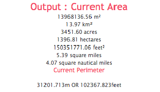
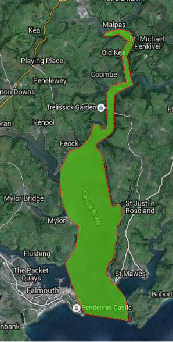
This data reveals interesting trends that depict a complex estuarine system. It is important to note that the areas calculated using ‘Google Earth’ (Figure 3.2) are estimates and do not represent exact values. To calculate the mean salinity in the estuary, an average was taken across all seven stations sampled. The same process was used for the offshore stations to obtain an average for the seawater salinity. To obtain the freshwater flux into the estuary, the sum of the discharge from the Fal River (2.041m3s-1 average from 1978-2009) and the discharge from the Kenwyn river (0.38m3s-1 average from 1968-2009) were taken. The residence time of the estuary is the time required to replace the total volume of freshwater within the estuary with ‘new’ freshwater. This was calculated to be 53 days.
While residence times are physical parameters, they play a vital role in determining nutrient levels and water contamination, which in turn controls the distribution of organisms throughout the estuary (NOAA). The residence time calculated was significantly greater than the values recorded for other large tidal estuaries within the UK, the Humber for example has a residence time of under 5 days (Vandenbruwaene et al., 2013). This large difference may be due to uncertainty associated with the values for freshwater and riverine flux, as these values are highly variable over various time scales.
The large residence time suggests that the estuary is at greater risk of hypernutrification and eutrophication, as well as contamination. An example of the issues associated with the high residence times of the Fal Estuary is the mining contamination event in 1992. This mining incident in Wheal Jane mine, which led to iron hydroxides, copper, zinc, cadmium and arsenic being released from the mines and flowing into Carrick Roads as pumps in the mine stopped working, to date the cost of engineering treatment for this incident has been greater than 20 million pounds. The high residence time resulted in contaminants residing in the estuarine system for much longer, and effects of this event can still be observed in certain areas of the estuary.
Click images to enlarge
Summary of Findings:
Chemical:
In terms of the chemical properties of the Fal Estuary, nitrate was found to behave non-conservatively, with removal occurring between the riverine and the seawater end member as a result of primary productivity. Both silicate and phosphate on the other hand plotted well against the TDL, suggesting it acts conservatively, with no significant addition or removal occurring within the sampled stations. The overall linear increase in oxygen concentration suggests that the lowest oxygen for each station is greater than the lowest for the previous station, indicating that oxygen concentration showed a general increase as samples were collected further up the estuary, towards the freshwater inputs, this suggests that riverine water has a higher concentration of oxygen than that of seawater.
Biological:
As estuarine phytoplankton are predominantly marine organisms, many species are unable to tolerate the fresh water found upstream of the estuary mouth; only euryhaline species remain (Figure 1a-e). Diatoms have adapted to estuaries changing conditions in order to outcompete other groups within the estuary, resulting in a diatom dominant phytoplankton population at every station sampled. Phytoplankton diversity varied significantly between stations, with no real trend, as a result of both abiotic and biotic conditions.
While zooplankton abundance was not as high as would be expected with the great phytoplankton abundance, two peaks in diversity were observed, associated with phytoplankton peaks providing increased food supply for zooplankton. Copepod larvae appear to constitute a large proportion of the population, indicating the presence of nursery grounds and an abundance of phytoplankton as a food supply encouraging the reproductive stage in zooplankton.
Chlorophyll concentration increased dramatically when travelling up the estuary, this can be explained by the increasing nutrient concentrations upstream, as these nutrients are essential in order for phytoplankton to thrive.
Physical:
The estuary was found to show evidence of behaving as both a partially mixed and salt-wedge estuary. The partially mixed portion occurs closer to the mouth of the estuary and Carrick roads where depth is great and riverine flow is not dominant. Further inland, where the salt wedge behaviour was observed the water basin is both narrower and shallower. A turbidity maximum was not observed within our samples however the turbidity did increase further upstream, suggesting a null point could lie upstream from station 7.
The area of the Fal Estuary (Figure 1) was calculated using a ‘Google Maps’ extension.
The depth of the estuary was calculated by averaging the depths of each station.
Average depth: 19.81m
These values can then be combined to estimate a volume for the estuary. (Area x Depth)
Volume of estuary: 2.76x10⁸m3
Volume of tidal diamond: 3.91x10⁷m3
Tidal Period: 12.42h
(The Fal Estuary is in a M2 tidal area)
To calculate the flushing time of the estuary the calculation:
Flushing time: 87.67h
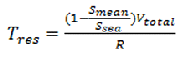
Residence time can also be calculated using freshwater influx and salinity ranges within the estuary using the equation below.
Smean = 33.84 psu
Ssea = 35.26 psu
Vtotal = 2.76x10⁸m3
R = 2.421m3s-1
Tres = 4591137.8s or 53 days
| Chemical |
| Biological |
| Physical |
| Biochemical |
| Physical |