


University of Southampton 2015©

GEOPHYSICS

INTRODUCTION:
Habitat mapping is important in understanding how the marine ecosystems interacts, supporting the identification of protected areas, assessing the extent of habitats and helping the management of anthropogenic activities[1]. A geophysical survey was conducted in the upper Fal estuary using a sidescan sonar in order to create a habitat map. A video footage was combined with the sidescan for ground truthing. The Fal and Helford is a Special Area of Conservation (SAC)[2], so grabbing is prohibited due to its capacity of disturbing the habitat.

METHOD:
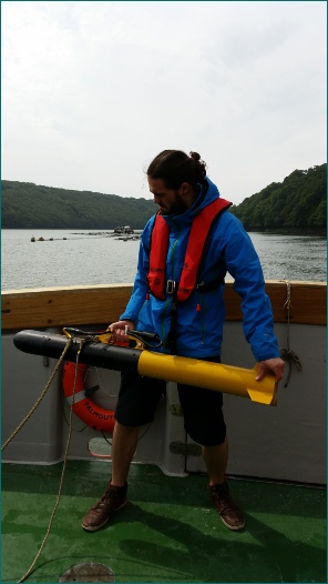
The side scan sonar was towed behind the boat along a pre-plotted course up the Fal estuary. The route was determined by the group in the previous evening’s planning session. It started from the mouth of the river and continued until the skipper could no longer navigate any further due to the decreasing depth of the channel. This route created and single long transect broken only by slight turns to follow the river path. The side scan data was printed inside the boat and the turn data was kept in the final habitat map. During the transect points of interest were noted to allow truthing of the data on the return journey. This involved lowering a camera to the sea bed to confirm whether the sonar images corresponded with the expected sediment or object for the return image appearance.

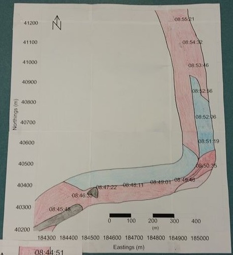
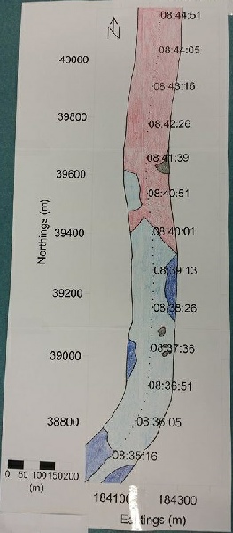
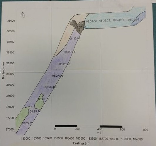
Figure 1-3 - images of individual section of the habitat map.
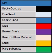
Figure 4 - Key for habitat maps
(Click each image to expand)

To see the full poster, click HERE

References:
[1] MESH Project. MESH Guide to Habitat Mapping. Joint Nature Conservation Committee, Peterborough, UK. (2008)
[2] Langston, W.J. et al. Characterisation of the South West European Marine Sites: Summary Report. Marine Biological Association of the UK, Occasional Publication No. 14. Pp 112 (2003)
1
2
3
4