


All the information shown on this website are our own views and not those of the NOCs or the University of Southampton


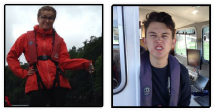
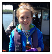
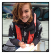
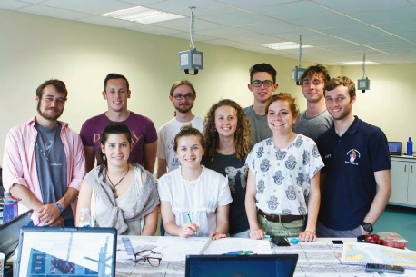
MEET GROUP 11
Introduction
Located in the South West of Cornwall (UK) lies the Fal Estuary, an area of huge scientific importance and high biodiversity in both fauna and flora. Shaped during the most recent ice age, the Fal Estuary was previously a river which has since drowned, allowing the rising sea level to fill the river valley, forming the ria which we now see. The estuary is a macrotidal system experiencing tidal ranges of 5.3m in Falmouth at the mouth of the estuary, and 3.5m at Truro located at the head of the estuary. Considered to be the third largest natural harbour on the planet, the Fal has 6 major tributaries, with the whole estuary covering a total area of 24.8km2.
With habitat types ranging from sand dunes and mudflats to rugged coastlines and
tidal rivers, the Fal Estuary is home to an impressive biodiversity. Designated as
a Special Area of Conservation (SAC) by DEFRA, the Fal Estuary exhibits the largest
maerl beds in the South Western UK. Maerl is a keystone species for the ecosystem
as it provides a perfect breeding ground and nursery for some invertebrates and fish
larvae. Being a slow growing calcareous algae, maerl is under threat from such human
activities as dredging and the anchoring of large commercial ships (as well as anchoring
of smaller leisure craft).
What did we do?
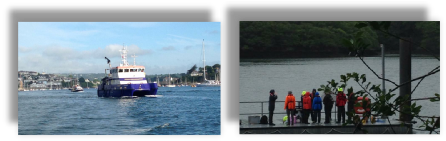
Arriving in Falmouth on June 22nd, we spent two weeks collecting data on some of the biological, physical and chemical factors that contribute to the functioning of the Fal Estuary. During the field course, we carried out four practicals at different points along the estuary to produce a comprehensive survey of the system as a whole. During the session on Callista, we conducted a study of the nutrients, phytoplankton, zooplankton, and dissolved oxygen concentration of the water column at three different offshore locations, as well as analysing the photic depth through the use of a secchi disk. Another one of the practicals along the estuary took place on the King Harry Pontoon where we took a time series of the physical factors and chlorophyll for the surrounding waters. Following this, we took a geophysical assessment of the topography of the mouth of the estuary on the vessel Xplorer, producing a sidescan sonar image along with video images of the estuary bed for the production of a habitat map. Finally, we took a general survey of the estuary itself using the R.V. Bill Conway where we took secchi disk depth measurements, ADCP flow measurements, zooplankton horizontal tow samples and phytoplankton samples, dissolved oxygen and nutreint concentrations, as well as CTD profiles of the water column. Our findings are presented on this site, giving a temporal and spatial synopsis of the Fal Estuary during our stay.
The pontoon practical was a morning activity that introduced the group to new equipment and sampling techniques. The focus was on investigating daily variations in the biological, chemical and physical parameters of the Fal Estuary.
The offshore practical on the research vessel Callista, required groups to design their experiment; setting an objective, choosing the correct methodology and deciding what factors to sample in order to gauge an understanding on the parameters in question.
The estuary practical on the R. V. Bill Conway was a full day out on the Fal Estuary, where the group surveyed changes in the biological, chemical and physical properties of estuary along its length. The group used the nutrient profiles recorded to infer about the processes occurring in the estuary.
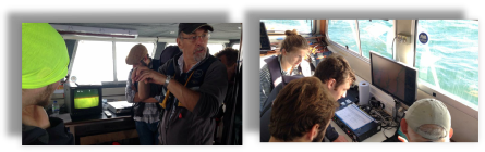
The geophysics practical was a morning session on board the research vessel Xplorer. The group familiarised themselves with sidescan sonar and spent the following day in the lab, interpreting the data collected to produce a habitat map of a small area near zone point, a headland at the mouth of the Fal Estuary.
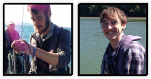


Oliver Bray
Mischief officer
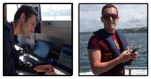
William Cutting
Time team 1
Matthew Ferguson
Sidescan shaman
Will Grace
Time team 2
Anna Jenkins
Assistant to the Chief sciencer
Tom Lees
Hair and Makeup
Anna San Llorente
Web wonderwoman
Madlaina Michelotti
Graphing guru
Mir Walker Browning
Terrance wrangler
Dominic Short
Data diva
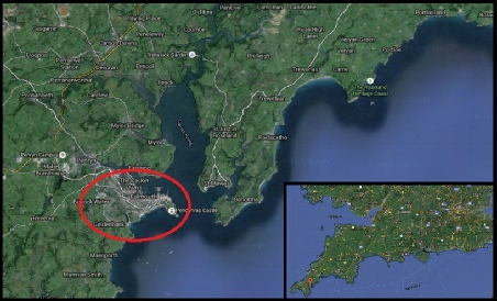
Figure 1.1 Map showing location of the Fal estuary and the red circle is the location of Falmouth.
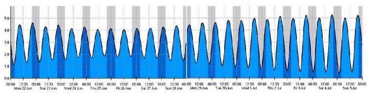
Fiugre 1.2 Tidal diagram of the two week period covering the field course (Monday 22nd June 2015 to Saturday 4th July 2015.
REFERENCES.
Hall-Spencer, J. (1998). Conservation issues relating to maerl beds as habitats for molluscs. Journal of Conchology, Special Publication 2, pp.271-286.
Mcleod CR, Yao et al., The Habitats Directive: Selection of Special Areas of Conservation in the UK, 2nd Edition, jncc.gov.uk/sacselection.
| Biological |
| Chemical |
| Physical |
| YSI Probe |
| Current Meter |
| Chlorophyll |
| Sidescan Sonar |
| Underwater Video |
| Poster |
| Biological |
| Chemical |
| Physical |