Disclaimer: These findings are the personal interpretation of the students involved and do not reflect the views of the University of Southampton, the National Oceanography Centre or Falmouth Marine School.


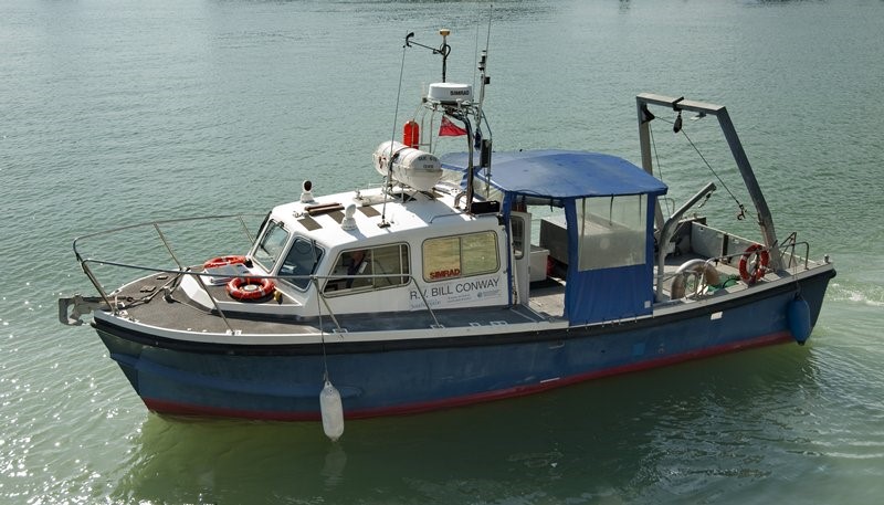
RV Bill Conway
Bill Conway is a 11.74m research vessel that belongs to the University of Southampton. The vessel has been designed specifically for scientific purposes such as surveying, teaching, diving and research. It can operate at sea up to 60 miles from land with 12 passengers and 2 crew members, carrying a range of equipment including a CTD operated by an on-board winch and an ADCP.
MTS Viking
MTS Viking is a 22m multi-purpose landing craft built in 1988 that belongs to the local Marine & Towage services company. It was rented specifically for the field course in order to carry out habitat mapping of the Fal Estuary using a sidescan sonar and underwater video camera.
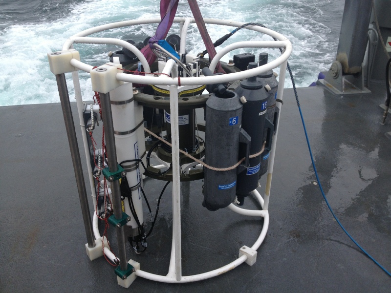
CTD
CTD stands for Conductivity Temperature Depth, as these are the basic parameters which this piece of equipment can measure. The CTD Rosette can also hold many extra instruments for measurements of other factors; for our purposes it was equipped with 6 Niskin bottles, a fluorometer and a spectrophotometer.
ADCP
The Acoustic Doppler Current Profiler has four acoustic transducers which use trigonometric relations to enable the measurement of the speed and direction of ocean currents. It emits high frequency sound pulses which are then scattered by particles suspended in the water. The signal received by the ADCP is either high or low depending on whether the particle is moving away or towards the instrument. Measurements are done based on Doppler Shift principle - frequency shift is proportional to the speed of the water.
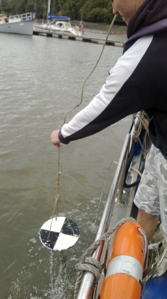
Secchi Disk
This simple instrument was invented by a Vatican monk as a weighted white disk and later improved upon by Dr Whipple, who added black quarters for contrast. It is used to measure 1% light penetration into the water column and was used in Falmouth as a comparison to the CTD and pontoon data of irradiance and turbidity.
Plankton Net
Plankton nets are used to carefully collect planktonic organisms, of any size, from the surface and at various depths in the water column. The nets collect organisms as they are being towed by a research vessel. Plankton nets have a long funnel-shaped mesh which differs in size depending on the dimensions of the material of interest and the volume of water needing to be sampled. A bottle is attached to the end of the net to store the sample.
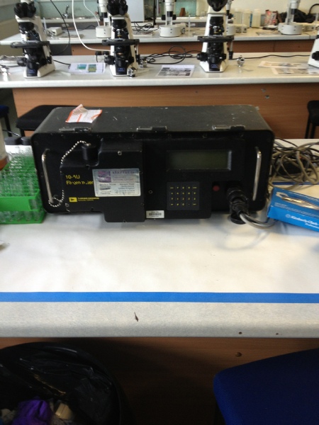
Fluorometer
A fluorometer measures the amount of chlorophyll-a in the
water column, as the chlorophyll pigment absorbs the blue light and instantaneously emits light in the red wavelengths. The instrument emits a beam of blue light with a wavelength of around 440nm and detects the light reflected by the chlorophyll pigments – fluoresced in the longer red wavelengths of roughly 685nm. Calculations are based on the direct proportion between fluoresced light and the concentration of the material of interest. This results in a calculated value for the concentration of chlorophyll, and therefore phytoplankton, in a sample.
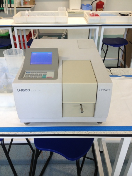
Spectrophotometer
A machine used to identify the concentration of a coloured component. The chosen solute is coloured and a light source projects either a single or double beam of light into the sample. Depending on the amount of dyed constituent, the light beam is transmitted or reflected and directed into a receiving component.
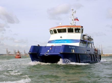
RV Callista
RV Callista is a £1million Research Vessel owned by the University of Southampton. It is a 47ft long catamaran which is equipped for Oceanographic Research.
In Falmouth, Callista was used to survey the conditions offshore.
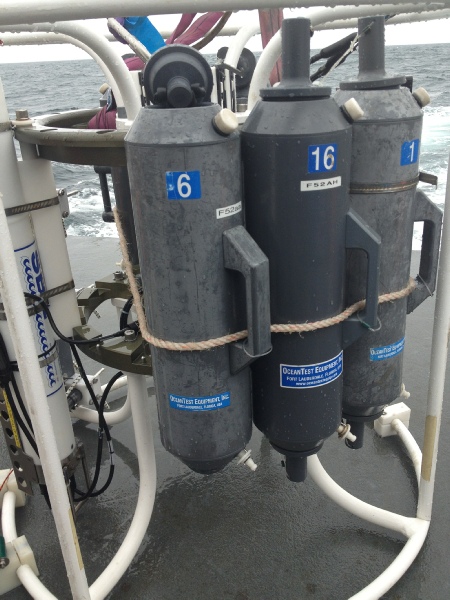
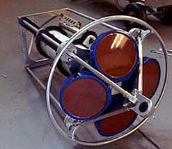
Niskin Bottle
This is the most widely used sampling bottle within oceanography - it has air-tight lids connected by elastic and held open with plastic ties during a descent, and a tap used for collecting small samples once the bottle is shut. The bottle is closed manually from the boat at pre-chosen depths. These bottles ensure no air can reach the sample, which is essential for sample analysis as it prevents contamination and enables the measurement of dissolved oxygen in the water column. It was used to collect samples for all other nutrient and chlorophyll data on the RV Callista and RV Bill Conway.
Side-scan sonar
Sonar systems are used for creating images of the seafloor. Technology uses sonar device that emit sound pulses down the water-column. The intensity of received acoustic pulses reflected back from the sea floor creates an image of the examined surface. The frequencies used by the sonar can be altered, and range from 100 to 500 kHz – the higher the frequency the better the resolution.
Transmissometer
The transmissometer is an instrument attached to the CTD that was used on RV Bill Conway and RV Callista. A light source emits a beam of light of a known wavelength towards a receiving light detector. By measuring how much light actually reaches the receptor, and isn’t absorbed/blocked by suspended sediment, particulate matter and plankton, we can infer the amount of turbidity. The amount of light recorded by the detector can be easily converted and provide information about the light attenuation coefficient.
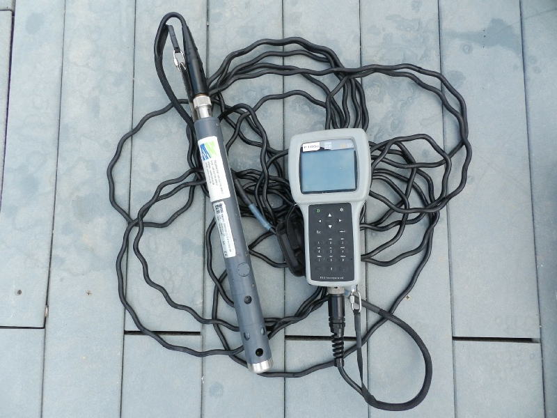
YSI Probe
The YSI Probe is a multiprobe that can be hand deployed by one person and measures mulitple properties of the water column such as temperature, depth, salinity, dissolved oxygen, pH and turbidity simultaneously. It was deployed off the pontoon in the estuary, every half an hour at one metre intervals, to create a time lapse of the estuary.
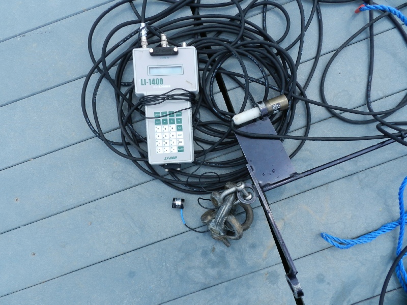
Light meter
The light meter was used on the pontoon in the estuary. It consists of two probes attached to the meter which processes the data and displays readings. One probe is to be held at a constant height in the open air whilst the other probe is lowered to various depths and the difference between the 2 readings is used to infer light penetration at metre intervals. The two probes are calibrated by holding them at the same height above the water before deployment. If the readings are different, the difference can be used to correct the following readings.