
This website was designed by a group of second year students of Marine Biology and Oceanography from the University of Southampton to present key findings from the Falmouth field course (Falmouth, Cornwall, UK) conducted between June 21 to July 1, 2016.
Multiple biological, chemical, physical and geological samples were collected along
the Fal estuary and surrounding offshore water throughout the course, as part of
a hands-
Study site information: Falmouth.
The Fal Estuary, situated at the south coast of Cornwall, is a Ria that was drowned
during the Holocene (Pirrie et al., 2003), now spanning 18.1km from its source in
the Goss Moor to the mouth of the river at Pendennis point (Fig. 1). Several rivers
and creeks confluence into the Fal estuary such as River Truro, River Kennal, Penryn
River, Pill Creek, Restronguet Creek and Mylor Creek which gives rise to a total
volume of 1.35x10⁷ m-
The Fal’s estuary has been subjected to various pollutants especially the discharges of heavy metals from centuries of mining activities. Important metalliferous mining occurred during the 19th century and the Fal Estuary catchment area was one of the principle sources of As, Zn and Cu in the world (Bryan and Gibbs, 1983;Bryan et al., 1987). Consequently, metal contamination within the intertidal sediments of the Fal Estuary are the highest in Britain (Warwick, 2001). Despite the closing of mines, heavy metals continue to leach into the rivers (Somerfield and Warwick, 1994). However, The Fal and the Helford have a variety of environments such as biologically rich sandbanks, mudflats and sandflats, which support a diverse community of marine species including eel grass beds and maerl (JNCC). As a result, the area was selected as a Designated Special Area of Conservation (SAC) (JNCC).
References
Bryan, G. W. and Gibbs, P. E. 1983, ‘Heavy metals in the Fal Estuary, Cornwall: A
study of long-
Bryan, G. W., Gibbs, P. E., Hummerstone, L. G. and Burt, G. R. 1987, ‘Copper, zinc,
and organotin as tong-
JNCC, no date, Fal and Helford, [Online], Available: http://jncc.defra.gov.uk/protectedsites/sacselection/sac.asp?EUCode=UK0013112 [accessed 2016, June 26th].
Pirrie, D., Power, M. R., Rollinson, G., Camm, G. S., Hughes, S. H., Butcher, A.
R. And Hughes, P. (2003) ‘The spatial distribution and source of Arsenic, Copper,
Tin and Zinc within the surface sediments of the Fal Estuary, Cornwall, UK’, Sedimentology,
50, 579-
Somerfield, P. J. and Warwick, R. M. 1994, ‘Soft sediment meiofaunal community structure
in relation to a long-
Warwick, R. M. 2001, ‘Evidence for the effects of metal contamination on the intertidal
microbenthic assemblages of the Fal Estuary’, Marine Pollution Bulletin, 42, 145-
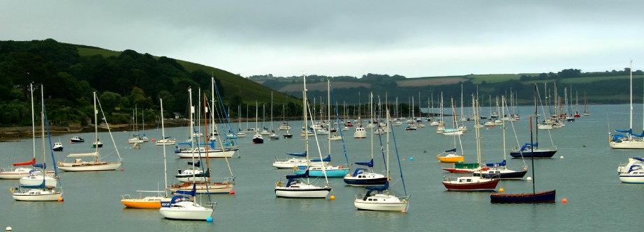
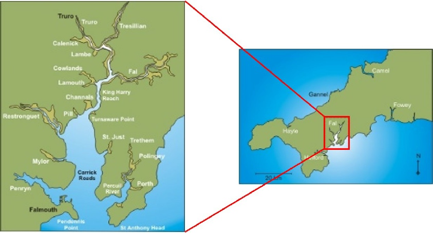
Fig. 1 Map of the Fal Estuary and surrounding area
Disclaimer
This is the opinion of the individuals of group 6 and not the work of the University of Southampton