Disclaimer: The above statements and veiws are those expressed by the team members of group 5 and do not reflect those of the University of Southampton or the National Oceanography centre staff or other students
Estuary
Date: 29/06/2015
Time: 11:10-15:10 UTC
Location:
between
50 12’57.76’’N 005 1’39.65’’W
50 08.723N 005 01.380W
Low tide: 09:13 (UTC) 1.20m
High tide: 15:10 (UTC) 4.60m
Weather:
5/8 cloud cover, strong southerly breeze
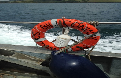
Vessel: Bill Conway
Introduction
An estuary is an enclosed body of water that is influenced by the tide, waves and rivers. These effect the chemical and biological structure of the water column. The aim of the investigation in the Fal estuary was to collect nutrient (dissolved silicon, phosphate and nitrate), phytoplankton and zooplankton samples travelling downstream from the pontoon at King Harry Ferry port to Black Rock at the mouth. Analysing our samples in the lab would allow us to see the changes to the nutrient concentrations that occur moving out of the estuary.
The ADCP enables us to see the flow velocity and direction. Flow in and out of the estuary will have an impact on the concentrations of nutrients in the estuary. The ADCP data will allow us to calculate the predicted flow into the estuary as we were taking our measurements during a rising tide. We were conducting our measurements from 12:26 until 15:20 (UTC).
Methodology
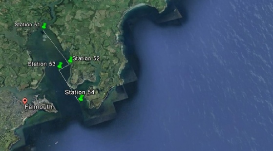
We decided to sample at 4 stations as we wanted to show variability within the water body with fresh and salt water exchange.
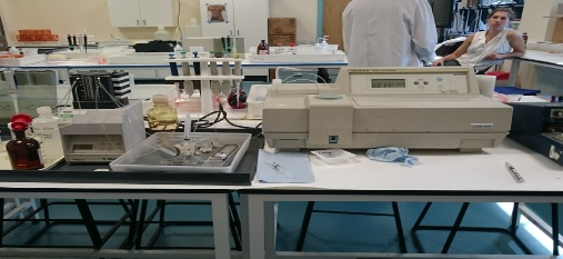
The nutrient, chlorophyll and phytoplankton samples were taken by deploying the Niskin bottles attached to a rosette. Attached to the rosette also was a CTD. At each station this was deployed and from the CTD profiles on the computer, 3 depths were decided in which to fire the niskin bottles and collect sample water. It was taken to the ‘wet lab’ and filtered into sample bottles for nitrate, phosphate and silicate. Chlorophyll samples were put in acetone whilst phytoplankton samples were placed in iodide. All these would be analysed in the lab the following day.
An ADCP transect was taken at each station across the river channel as close the bank as possible.
At the final station a zooplankton net was deployed for five minutes. The boat drifted from the initial release position. The sample was placed into a bottle ready for the lab the following day.
Location
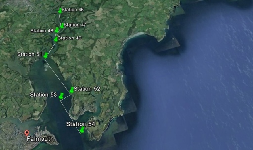
Group 5 Estuary sampling Stations starting at King Harry Ferry Port finishing at Black Rock.
Group 3 sampling sites in the Fal estuary from Black rock to King Harry Ferry Port, carried out from 07:00 - 11:10 UTC