
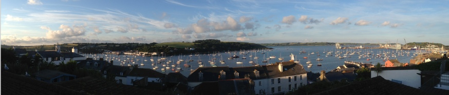

Introduction
At 08.15 BST on the 2nd July 2014, the RV Bill Conway was used to take seven samples up the Fal River. At each station a CTD rosette equipped with a transpisometer, a fluorometer, eight Niskin bottles and a CTD monitor was deployed to take a vertical profile of the estuary, and a transect across the width of estuary was undertaken with the ADCP. At three of the stations, a plankton net was deployed to take a sample of the zooplankton, and a seawater and freshwater end member was taken of the salinity at the first and last station. From the Niskin bottles, water samples were taken to analyse back in the laboratory for silicate, nitrate, phosphate, dissolved oxygen and chlorophyll content.
The aim of these samples is not only to observe how the concentrations change over the river, but also to plot a mixing diagram for each of the nutrients and to observe if there are any issues with organic pollution in the estuary. Between stations five and six a mussel farm was observed, however it was not currently in use, apparently due to high nitrate concentrations, which will be shown in the samples taken from these stations. A continuous measurement of temperature and salinity was monitored using a thermosalinograph as the vessel moved from saline to fresh water, and lastly a Secchi disk was used at each station to measure the depth of the euphotic zone and how it changes along the estuary.
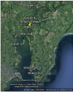
Sampling Stations
Station 1 Latitude 50°09.008N Time 0726 GMT
Longitude 005°01.729W Weather 4/8 octants Depth 37.6m Wind speed 7 knots
Station 2 Latitude 50°10.135N Time 0831 GMT
Longitude 005°02.470W Weather 4/8 octants Depth 31.6m Wind speed 12 knots
Station 3 Latitude 50°11.258N Time 0859 GMT
Longitude 005°02.248W Weather 4/8 octants Depth 25.2m Wind speed 14 knots
Station 4 Latitude 50 °12.210N Time 0936 GMT
Longitude 005°02.421W Weather 3/8 octants Depth 20.7m Wind speed 12 knots
Station 5 Latitude 50°12.476N Time 0958 GMT
Longitude 005°01.675W Weather 2/8 octants Depth 19.6m Wind speed 1 knot
Station 6 Latitude 50°13.325N Time 1035 GMT
Longitude 005°01.612W Weather 1/8 octants Depth 14.3m Wind speed 6 knots
Station 7 Latitude 50°04.351N Time 1108 GMT
Longitude 005°00.921W Weather 4/8 octants Depth 6.1m Wind speed 5 knots
For Methods see Offshore Methodology (changes in Plankton Net Sampling discussed here)
Disclaimer: The views expressed above are the opinion of the authors only and NOT that of University of Southampton or National Oceanography Centre, Southampton.
