Geophysical: Methods
Falmouth, 2014
The methods used were:
Five videos of approximately 9 minutes each were recorded in order to help identify the organisms present in the study area. This ground truthing helped to distinguish the seafloor properties, such as sediment composition and morphology type, thus complementing the information provided by the side scan sonar.
The acoustic backscatter response recorded by the sidescan sonar system is well suited for the detection of changes in sediment type, because to a large extent it appears that spatial trends in backscatter correspond to changes in texture and microtopography of the sediments (Johnson and Helferty, 1990; LeBlanc et al., 1992 & 1995). We analysed the backscatter produced to identify the bed roughness and the main features of the seabed. After the identification of the features, we used the Surfer software to draw a contour map of the study area and coloured it to emphasize the different sediments in the seabed.
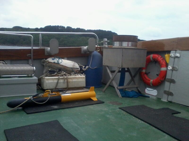
Photo of the sidescan sonar
26.06.2014
Weather: Moderate rain, some heavy showers
Cloud coverage: 8/8 octants
Wind speed:
force 3 (Beaufort scale)
Low water: 11:04 UTC (0.9m)
High water: 16:39 UTC (4.9m)
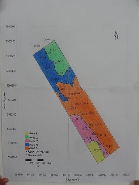
Habitat Map