Overview
Nine transects were sampled with the sidescan sonar tow fish (Figure 30) in total between three teams, each team sampling three transects. In the morning there was a cloud coverage of 8/8 and light rain, by noon it was sunny and cloud coverage was about 3/8. From this survey it was decided to use only transect lines 1, 2 and 3. From the sidescan print out (Figure 31), areas of different backscatter signals were identified, measured and transferred onto a transect map. With the transect map and video recording it was possible to estimate different benthic habitats.
An object can be seen from the backscatter sidescan print out, which suggests the
tow fish surveryed a shipwreck. The possible wreck is located at Northings 5559956,
Eastings 354912.71 at an assumed depth of 9.5 m. No additional data of the ship wreck
could be found on-
Figure 31: Printed Sidescan sonar backscatter transect lines 1, 2 and 3.
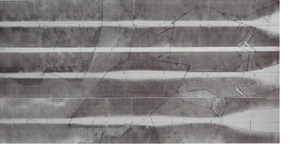
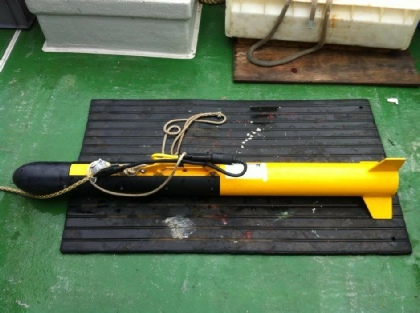
Figure 30: Sidescan Sonar “fish” (model 159 Digital – serial number 942