Home Offshore Geophysics Estuary Pontoon Researchers
Calendar
June and July 2014
M
T
W
T
F
S
S
23/06

Offshore
24/06

Labs
25/06
Data Process
26/06

Geophysics
27/06

Labs
29/06

30/06

Labs
01/07
Data
Process
02/07
Data
Process
03/07
Data
Process
04/07
Data
Process
05/07
End of Field course

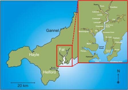
The Fal estuary is a drowned river valley, known as a ria, located on the south coast of Cornwall, England. It is a large estuary, covering 24.8km2, with 6 major tributaries. The tidal range is 5.3m at the estuary mouth at Falmouth and 3.5m at Truro, located at the head of the estuary.


The estuary is a Special Area of Conservation (SAC) due to maerl beds present in an area between St Just and St Moore’s. Maerl is a slow-growing calcareous algae which acts as a nursery bed for many commercially-important fish and shellfish. Because of its slow growth, maerl is at particular risk from activities such as anchoring and dredging.


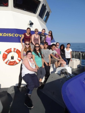
Oceanography and Marine Biology students from the University of Southampton carried out a field course project investigating physical, chemical and biological features of the Fal estuary and offshore environment.


Group 1 consisted of 12 students, with a mixture of academic backgrounds, details of which can be found on the Researchers page.

Introduction

Fal Estuary and region.

Tidal cycle at Falmouth for June 2014. Spring tides are where the largest tidal height range, and neaps are where the tidal height range is smallest.

Disclaimer

The views expressed on this website are not those of the University of Southampton or the National Oceanography Centre.