
Reference List
Meet the team!
Disclaimer
The views and opinions expressed are of those of the members of Group 8 and are not representative of University of Southampton or National Oceanography Centre.
Lab Protocol

INTRODUCTION
Plymouth Sound is an ocean inlet located in SW Britain. It is supplied by freshwater
from the River Tamar. The Sound and Estuaries of Plymouth are under investigation
by the Environmental Agency and English Nature with areas of marine conservation.
The survey was carried out within the breakwater zone which is identified by the
English Nature report on Plymouth Sound and Estuaries (File: ENRR208), published
in 1997. Outer sound has a steeper slope than the coastal regions and according to
Moore et al. (1999), the breakwater zone is affected by significant turbidity increase
and salinity reduction, due to out flow of the River Tamar. Some rare sponge species
are observed south of the breakwater such as Axinella damicormis (Langston et al.,
2003). Another study carried out by Parry et al. (1999) has contrasted sediment granulometry
with macrofaunal assemblages and found out that coarse sediments hosted greater number
of species with higher diversity and that body size is non-
METADATA
Date: 03/07/19
Time of study: 08:30-
High water: 06:57 5.23m
Low water: 13:10 0.88m
Tidal cycle: Spring
Sea conditions: Very calm
Wind: prevailing South West 10.56mph
Air Temperature: 16 degrees C
Weather: sunny
Cloud cover: 2/8 octants
Vessel: Commercial boat-
Geophysics
SAMPLING METHODS
Side scan sonar:
The start location of the survey was deciphered using the EDCUS navigation system
on the vessel. The projections were converted to Northing and Easting system using
a coordinate conversion programme on board. There other track lines are generated
parallel to the south of the former line with same length and distance of 100 meters
using HYDROPro. …… model side scan sonar tow fish is towed behind the vessel R/V
Echo Sounder along the pre-
Towed video system:
Similar to side scan sonar, the system is towed behind a vessel approximately a meter above the seabed. The live video of the sea bed is monitored and recorded on board. Towed between the locations 50 ° 19.801N, 004 ° 08.976 and 50 ° 19.849 N 004° 09.334 W.
Creating the map:
To create the map, the side-


Towed Video system

Van Veen Grab

Tow Fish
AIM
To collect data to represent the physical set of the sediment and couple it with biological data to form a habitat map using side scan sonar for the sediment structure and towed video system for biological assessment.
RESULT
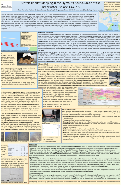
A brief summary of the research findings and conclusions are given here. For more information, see the full poster.
• Rhodophyta and Chlorophyta were dominant across all three transects especially
in regions of exposed rock. However, they also grew within the troughs of ripples
present in transect 3 -
• 4 different habitat types were observed (1 – kelp covered rock, 2 – gravel waves, 3 – mudflat and 4 – sand covered rock). Screen grabs were taken of each of these, and the percentage cover of each species determined. Site 2 and 4 were most similar in species composition, whereas site 1 and 4 were the most different.
• Of the sites observed, sites 2 and 4 were the most similar. This is most likely due to the absence of L. digitata and Cladophoraceae
Geology
The structure of the seabed is heavily influenced by the geology of the area. Folding of rocks is responsible for some of the outcrops and troughs seen in the side scan trace. The shape of these bedforms influences flow around the boundary layer, affecting how sediment and water is moved and how much energy areas have. Features such as the Rhodophyta growing in troughs of the gravel waves can be explained by this as these are more sheltered static environments where the sediment is rarely disrupted, meaning the algae has time to grow in these troughs. The type of rock present over different areas means erosion occurs at varying rates, creating a number of different sediment types which correspond to different habitats.
(Click the picture to see the full poster)
| Flying Pig & Porky Pig |
| Falcon Spirit |
| Biological |
| Chemical |
| Physical |