
The Falmouth field course for second year Marine Biologists and Oceanographers took
place from the 22nd of June to the 4th of July 2015. The aim of the two week field
trip was to gain a greater understanding of the biological, chemical, physical and
geophysical conditions of the Fal Estuary and the near offshore water. The investigations
that were conducted took place at a range different locations; estuary data was collected
from the Truro and Fal rivers and pontoon data was collected near Trelissick gardens
mid-way up the river Fal, Habitat Mapping took place just off of Porthbeor beach
and the offshore data was collected from Lizard Point and the surrounding area. The
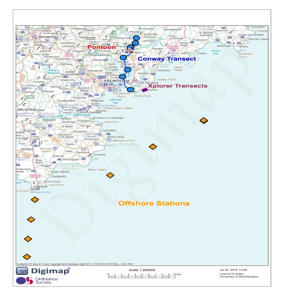
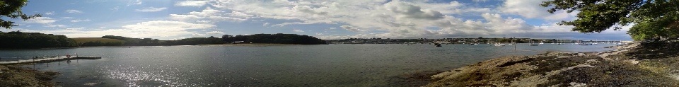
positions of all the sites are shown on the map (Figure 2) below. Students were put
into groups for the field course and the findings of group 8’s investigations are
summarised in this website and some comparisons and similarities are pulled from
data collected by other groups or research from previous years. Group 8 was comprised
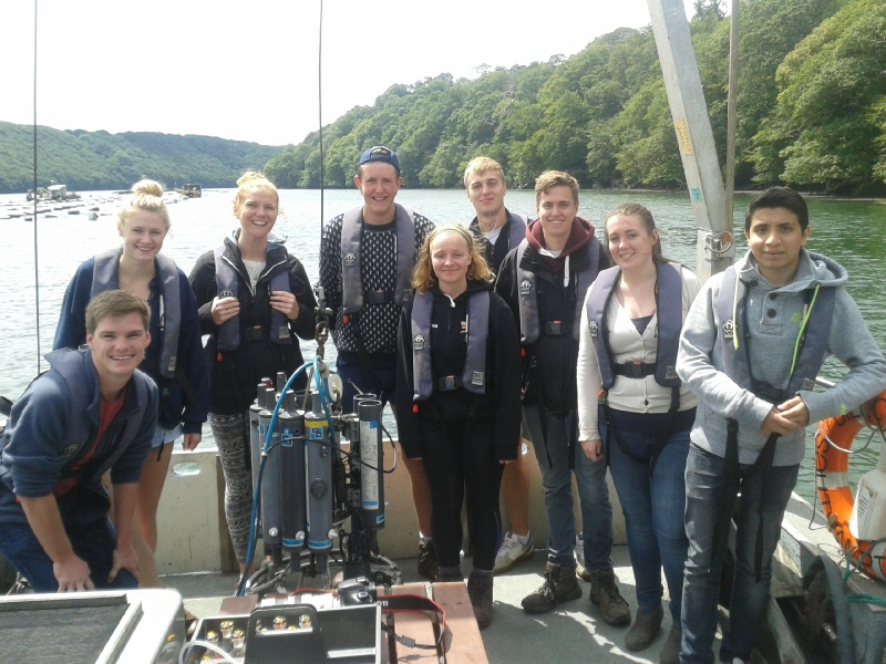
of 9 students; 3 oceanographers and 6 marine biologists. Below is a picture of the
members and on the ‘The Team’ tab there are short profiles for each. Group 8’s logo,
found at the bottom of each page of the website, shows the groups unofficial name
EL SHARKKE which is made up of the first letters of all of our first names. Throughout
the website we have enabled the graphs and photos to be enlarged when clicked for
greater clarity. Photo credit goes to Lizzie or Leanna. Enjoy our site!


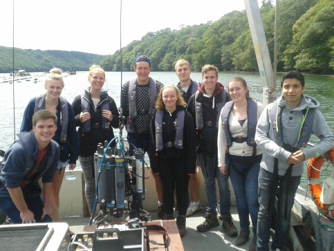
FIGURE 4 (above); The Team (from the left) - Adrian Bailey, Katherine Thomas, Leanna
Crowley, Sam Clough, Lizzie Hibberd, Kris Wood, Richard Gibbs, Emily Thompson and
Hattan Balkhi.
The Fal Estuary
As shown in figure 2, the river Fal flows from its source in Pentevale, through the
rest of Cornwall and into the English Channel at its mouth in Falmouth. The estuary
of the river extends 18km inland before reaching its northern tidal limit at Tresillian
(Pirrie, et al., 2003). This estuary is vital to the local economy due to the maritime
trade and tourism industries, as well as being an area of very high wildlife diversity
and richness (Deeble & Stone, 1985).
In the past, the estuary has been faced with many threats, the biggest of which has
been pollution due to mining of heavy metals in the Fal estuary catchment area.
The most significant heavy metal mining occurred on zinc, iron, manganese, copper,
arsenic and cadmium. The majority of the mines are located within the valleys of
the Carnon River, the River Fal and the Tresillian River (Pirrie, et al., 2003),
all of which flow into the Fal estuary. As a result any excess run-off from such
mines resulted in the addition of heavy metals into the estuary, causing toxic pollution
events. The Fal estuary is also known for having the country’s most extensive bed
of maerl and an extensive amount of sublitoral meadows of eelgrass. Both of these
provide an important nursery for a vast array of marine organisms.
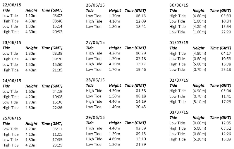
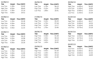
Within the estuary the spring tidal ranges vary from 5.3m at Falmouth to 3.5m in
Truro and therefore there is a mix of macrotidal and mesotidal ranges. The tides
are semi-diurnal and do not show any double high or low water. For the two weeks
that group 8 were surveying, the tide data is shown in figure 3.
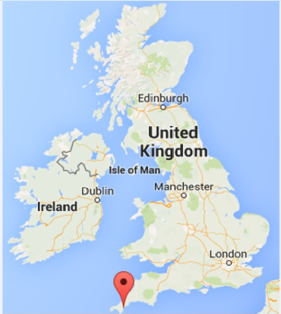
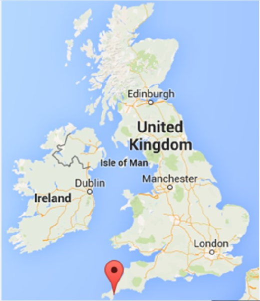
FIGURE 1 (right); Map of Britain with Falmouth labelled with red tag.
FIGURE 2 (below);
Map of Fal Estuary labelled with our sampling sites from the field course.
FIGURE
3 (below Fig. 2); tide tables for the field course duration.

Disclaimer; the views and opinions expressed are those of the individual and not
necessarily those of the University. ©El Sharkke 2015

References
Deeble, M., & Stone, V. (1985). A port that could threaten marine life in England's
Fal Estuary. Oryx, 19(2), 74-78.
Pirrie, D., Power, M., Rollinson, G., Camm, S., Hughes, S., Butcher, A., & Hughes,
P. (2003). The spatial distribution and source of arsenic, copper, tin and zinc within
the surface sediments of the Fal Estuary, Cornwall, UK. Sedimentology, 50, 579–595.
Maps - Figure 1 - www.googlemaps.com
Figure 2 - ©Crown copyright database
right 03/07/15 ordinance survey (digimap lisence)
FIGURE 5 & 6; calendars showing the months of June and July with our timetable for
the field course added.