


Geophysics
On Tuesday the 1st of July 2014 our group spent the morning on the Xplorer with the
aim to use habitat mapping methods to study an area of the seabed. Due to poor weather
conditions and high wind speeds on the day, we were unable to leave the estuary itself
without compromising the quality of our data. Data was collected using a side scan
sonar tow-
Side-
During the side-
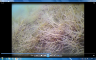
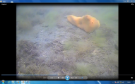
Video
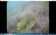
6 videos were recorded at several different locations using a drop camera. This enabled
us to see the nature of the sea-
Several species were identified using the videos that were taken ( excluding sea grass and maerl). These included:
- Furcellaria lumbricalis
- Ulva lactuca
- Ahnfeltia plicata
- Rhodophytus; Chondrus crispus
- Chorda filium
- Demospongiae; Suberites ficus
(Some snap shot images from the video are below)

Surrounding Area
Seagrass
Seagrass (Zostera marina spp.) is an angiosperm found in permanently submerged marine environments in Falmouth Estuary and provide a unique and critical habitat for local wildlife [1] the beds provide nursery grounds for many juvenile species and provide food sources for herbivorous larger species [2]. It is a sensitive species, with the survival of the beds based on stochastic events, similar to the flowering of the grasses which is based on and triggered by variations in water temperature. They are colonial organisms and entire beds can be generated from a single seed, and survive over one thousand years if left undisturbed. Additionally, seagrass beds are of crucial importance due to their ability to act as a carbon sink, and are one of the most effective organisms at doing so. In Falmouth estuary the most abundant seagrass species is Zostera marina which provides habitats for up to one quarter of the benthic species in the estuary [3].
Maerl Beds
Phymatolithium calcarium is the species of Maerl found in the Fal Estuary, it forms a complex habitat with high species and trophic group diversity [4]. P. calcarium prefers photic areas with a strong current [5]. It forms habitats for juvenile bivalve molluscs and echinoderms [5]. Maerl beds are protected in a SAC due to high levels of anthropogenic disturbance through fishing, chemical pollution and direct exploitation through extraction [4]. It is used commercially to increase soil pH as it has high levels of magnesium, iron and boron [6].

[1] Tyler-
[2] Connolly, R.M., 1994. A comparison of fish assemblages from seagrass and unvegetated
areas of a southern Australian estuary. Marine and Freshwater Research.45, pp.1033-
[3] Tuck, S., Dinwoodie, J., Knowles, H. and Benhin, J. (2011). Assessing the Environmental
Impact of Anchoring Cruise Liners in Falmouth Bay. Springer, pp.93-
[4] Barbera, C. 2003. Conservation and management of northeast Atlantic and Mediterranean
maerl beds. Aquatic Conservation: Marine and Freshwater Ecosystems. 13, S65-
[5] Kamenos, N. A., Moore, G. P. & Hall-
[6] Blunden, G., Campbell S. A., Smith, J. R., Guiry, M. D., Hession, C. C. & Griffin,
R. L. 1997. Chemical and physical characterisation of calcified red algal deposits
known as maerl. Journal of Applied Phycology. 9, 11-
[7] Pirrie, D. (1997). Mineral and Geochemical signature of mine waste contamination, Tresillian River, Fal Estuary, Cornwall UK. Environmental Geology, 29.
lactuca
plicata
Suberites ficus
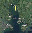
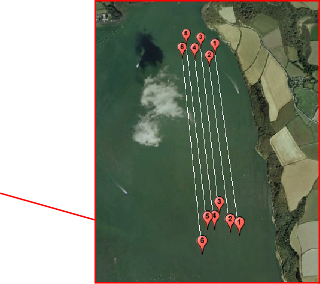
Video Locations

Discussion
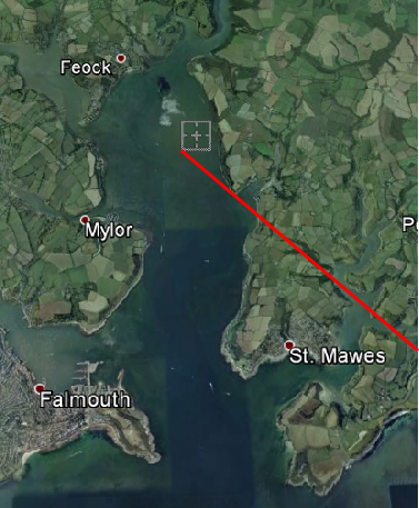
We surveyed an area ~200m off the west banks of St. Mawes, and just north of the majority of the maerl beds. There was little diversity in terms of geography and morphological or biological objects in this confined area. Medium coarse sand [1/4 – ½ mm] dominates the survey region [7], and we were able to confirm this from the sidescan sonar data and video analysis.
t is worth noting that there were limiting factors to our data collection; our survey location fell within the special area of conservation (SAC) and prohibited us from taking any grab samples. Additionally, due to strong currents on the day of, we were unable to use the camera whilst towing, and so our only option was to attempt to drift back along the same transects with the camera operational; our camera footage is not representative of our transect data from the sidescan sonar, and we were unable to confirm exact locations of objects found in the footage.
Another limitation encountered with the video footage is any objects or species living beneath the survey area, such as burrowing bivalves which would have been more clearly analysed had we been able to perform a grab sample. The morphological formation of the survey region was homogenous throughout, with the only variations occurring between species.