
Abstract
Surveys undertaken between 25th June 2013 and 1st July 2013 enabled enhanced understanding of the characteristics of the Fal estuary.
The geophysics habitat mapping project highlighted both anthropogenic and biological features, including presence of rocky shores, macroalgae and mearl. The pontoon study provided clear evidence of limited freshwater input, and dominance of tidal forces throughout with salinities ranging from 31.4 to 32.8. The estuary study gave enhanced understanding of the biogeochemical processes throughout the estuary with nitrate varying from 21μmol/l at the northerly point to 10μmol/l at Black Rock. Finally the offshore practical showed the differences in mixed and stratified water columns on and around frontal boundaries, and how these physical parameters affected the biological conditions with surface temperature ranging from 14.2oC in stratified waters to 12.4oC in mixed waters.
Through continuous sampling of the Black Rock station, both estuary and offshore
profiles allowed a transect from riverine stations within the estuary to a station
16 nautical miles offshore to be sampled. This has shown clear changes in the phytoplankton
and zooplankton community dynamics -
Background
The Fal estuary is classed as a ria or a drowned river valley, it has formed as the
result of sea level rise since the last ice age causing the flooding of the river
system. This is the reason for its intricate tree-
The Fal estuary is of high ecological importance within the United Kingdom and is a Special Area of Conservation. The benthic environment within the estuary is ecologically rich, containing nationally important maerl beds comprised of two individual species, Phymatolithon calcareum and Lithothamnion corallioides., As well as extensive seagrass (Zostera) meadows. These species are habitat forming species and provide specific niches which support a high biodiversity.
Aim
The Aim of the Falmouth 2013 field course is to gain a detailed understanding of the Fal estuary and how the system works as a zone of transition between freshwater inputs and coastal waters. Understanding the Fal estuary will involve a series of surveys using the vessels and equipment provided by the University of Southampton, National Oceanography Centre and the Falmouth Marine School. These surveys include:
- A collaborative survey over an 11 day period by all 13 groups to provide a time series of physical data from the King Harry pontoon.
- An offshore survey aboard the R.V. Callista with the objective of discovering how vertical mixing processes in the water off Falmouth affect, directly and indirectly the structure and functional properties of plankton communities. This involves observing the physical, biological and chemical processes occurring.
- A survey of the Fal estuary aboard the R.V. Bill Conway to gather data on the biochemistry of the estuarine system with the intent to create estuarine mixing diagrams, and also the physical processes that are present.
- A geophysics survey aboard the MTS Viking, involving the use of a side-
scan sonar fish, towed in transects along the maerl beds present along the shores of St. Mawes in the Fal estuary. The survey will provide data to produce a poster and habitat map of this site.
This website offers all information gathered by the observations and data collected
on these surveys, along with the data collected from the post-
Group3
Stephanie Britt – MSci Marine Biology
Lee Coley – MSci Oceanography
Eleanor Dening – BSc Oceanography
Christina Feilden – BSc Oceanography
Joseph Hudson – MSci Marine Biology
Ben Robinson – MSci Marine Biology
Victoria Sidwell – MSci Marine Biology
Christian Sitch – BSc Oceanography
Matt Townend – MSci Marine Biology
Mike Wilmot – MSci Oceanography
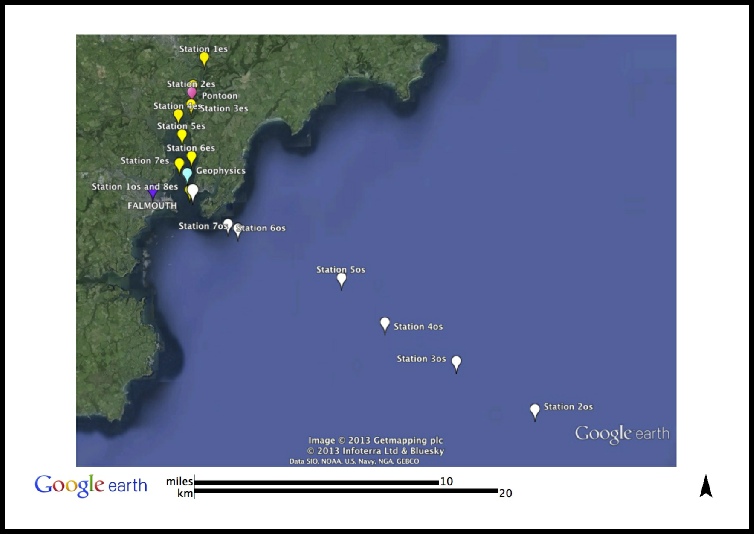
Fig. 1 A map of all the locations covered on the field course with respect to Falmouth.
Disclaimer: The opinions and conclusions expressed in this website are not affiliated with those of the National Oceanography Centre or the University of Southampton.
References
Pirrie D, Power M, Rollinson G, Hughes S, Camm G, and Watkins D, available
at projects.exeter.ac.uk/geomincentre/estuary/home.htm
| Introduction |
| Methodology |
| Physical analysis |
| Chemical and phytoplankton |
| Zooplankton |
| Introduction |
| Methodology |
| Side-scan |
| video transect |
| Limitations |
| Poster |
| Introduction |
| Methodology |
| Results |
| Limitations |
| Introduction |
| Methodology |
| Physical analysis |
| Chemical analysis |
| Biological analysis |
| Limitations |