WELCOME!
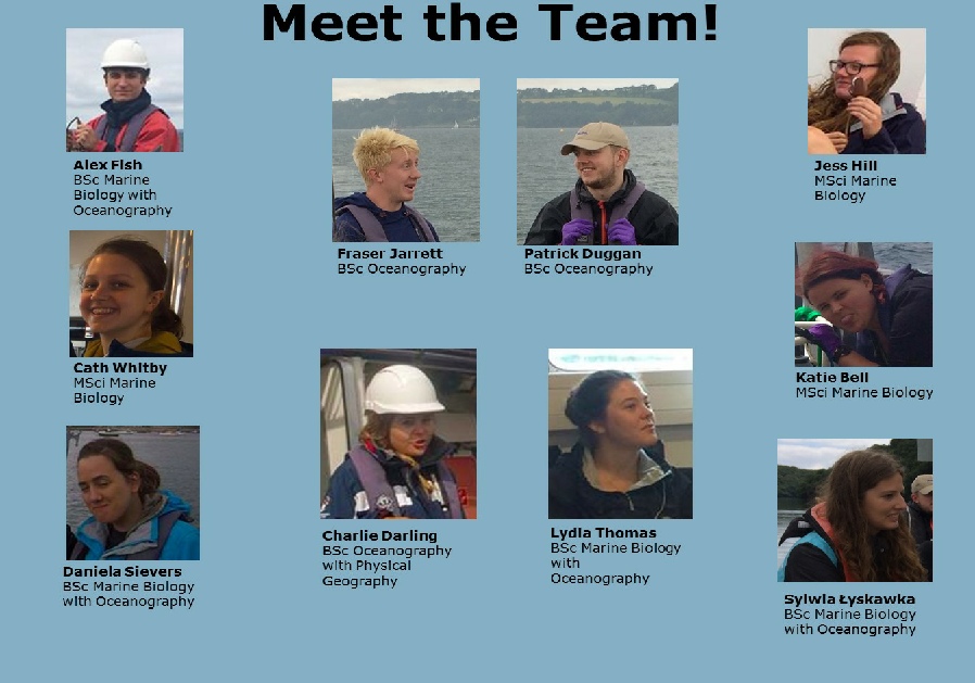
We are a group of 10 second year undergraduates from the University of Southampton studying Marine Biology and Oceanography degrees. For two weeks in July 2017, we conducted a range of surveys on the Fal estuary and surrounding areas, including nutrient sampling, habitat mapping, ADCP and CTD deployments and plankton trawls. We collected a range of biological, chemical and physical data, the results of which can be seen on this website.
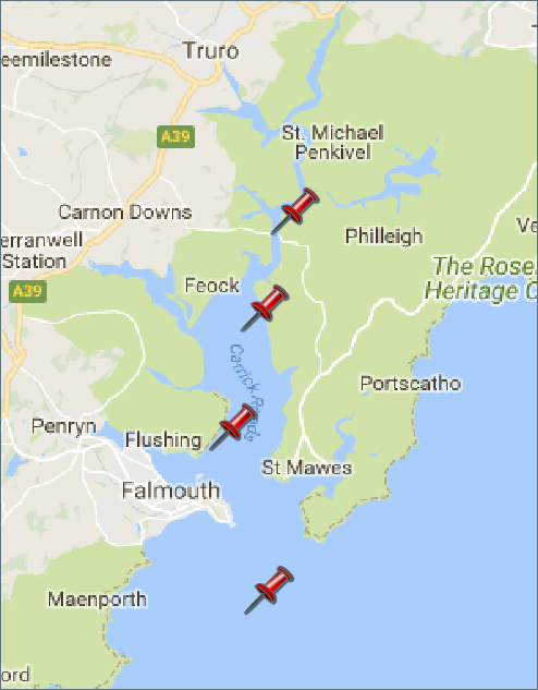
Map 1. Map displaying the Fal estuary located in South West Cornwall. The pins represent
the location of the 4 points of focus. The first pin in the map (north-
Background on the Fal Estuary
The River Fal is located in South West England, rising in Cornwall and reaching the English Channel in Falmouth. The Fal estuary (also knows as the Carrick Roads), like many on the South coast, is a classic ria filled in by meltwater during the last Ice Age, and is the third largest natural harbour in the world (Cornwall Guide, 2017), reaching depths of up to 34m at the southern end of the Carrick Roads (Natural England, 2017). The estuary is macrotidal in Falmouth, with a maximum spring tide of 5.3m, but is mesotidal at Truro, with a maximum spring tide of 3.5m (Pirrie, et al., 2002). The Fal system has a relatively low freshwater input, and therefore contains many fully marine habitats, with a high diversity of species across the area (Natural England, 2017). Tidal flows can reach speeds of up to 3kn in the upper part of the basin, and 1.5kn ebbing from the Carrick Roads (2kn after heavy rains) (Rainsley, 2008).
The Fal is designated as a Special Area of Conservation (SAC). This is due to the presence of:
-
-
-
-
Additionally, the presence of the shore dock Rumex rupestris means the site is protected under Annex II of the SAC legislation (JNCC, 2017).
In the lower Fal and Falmouth Bay, large maerl beds are designated as a Habitat of Principal Importance/Priority Habitat under the Natural Environment and Rural Communities Act 2006. The subtidal seagrass beds Zostera marina also fall under this classification (Natural England, 2017).
Historically, the Fal has been subject to large amounts of heavy metal pollution, such as by the Wheal Jane incident in 1992, when acid mine drainage overtopped the drainage systems and flowed into the river, causing over £20 million of damage by 2002 (Younger, 2002).
Disclaimer: The views and opinions expressed are solely those of the contributors, they do not reflect the views and opinions of the University of Southampton.
Click on the pins to explore the Fal Estuary, Offshore Falmouth, the Pontoon time series or Habitat Mapping
HOME
Falmouth 2017 -

| Introduction |
| Chemistry |
| Physics |
| Biology |
| Introduction |
| Physics |
| Biology |
| Chemistry |
| Introduction |
| Poster |
| Video Clips |