GROUP 11
FALMOUTH 2017
Seafloor Mapping
- To locate an area within the Falmouth (SAC) to survey.
- Produce a sidecan sonar printout of the area in question and further quantify with video/grabs. If species were present in grab and video images, identify them.
- Using surfer software to plot transect lines in conjunction with sidescan data to produce a habitat map.
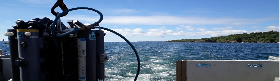
The sidescan sonar towfish was deployed off the back of the MTS Xplorer and towed along the 4 transects near the surface of the water to ensure that the survey data utilised as much of the 75 metres swath range as possible. Analysing the sidescan track printout areas of geological or benthic interest could be noted and marked onto the paper, these included a potential spreading site, bedrock outcrops and mobile sand substrata. The transects were followed by the deployment of an underwater video camera, giving a live video feed of the seafloor which showed the sediment composition and any flora and fauna that was present; Allowing for identification from video stills. To further qualitatively assess the sediment and species that may be present, mainly infauna, a Van Veen grab was deployed at specific site to ground truth other data.
Initially the method applied was to watch through the video transect footage taken
on the 10/7/2017 of the MV Xplorer. The transect was started at 50°07.0’N 5°04.4’W
and ended at 50°06.8’N 5°04.2W. The transect was not pre planned and was randomly
filmed by simply letting the boat drift. The boat happened to drift over the areas
of where the line transects were surveyed to create habitat boundary maps which allowed
cross referencing of the video and the habitat maps.
Due to the low visibility perhaps
due to a higher turbidity, the video footage provided very low resolution images
making it extremely difficult to accurately identify specimens but they have still
been noted in the table. The spiny starfish was the easiest to identify, as well
as maerl and were thus the seemingly most abundant specimens.
As the first videdo
shows that species abundance was often higher in the troughs of the symmetrical ripples
(bifurcated, and formed by waves), there was about a minute around half way through
the boundary first section of coarse sand, where there was a switch between species
populations having a higher abundance on the troughs to having an unexpectedly higher
abundance on the peaks. One theory behind this was that because the species observed
in the troughs and the peaks were the same (predominantly sea squirts)
Marthasterias
glacicuis was seen in pairs or a trio on 7 occasions but two groups of 8 were in
relatively close proximity. M. glacicuis are known to spawn during the spring and
summer months which could be explanatory of their close proximity to each other.
Due to a buoy being along the transect line, the research vessel had to deviate
from the planned line to avoid the buoy causing possible overlapping of habitat and
thus some boundary points were missed on the habitat and therefore may not be representative
of actual habitat. The Van Veen grab taken confirmed the maerl beds, as well as a
high abundance of sand mason worms, despite only one being seen in the video transect
but this could be due to low resolution causing an inaccurate species count.

Figure 2: Shows rocky substrate with two Marthasterias glacicuis in close proximity. Taken from the video transect.

Figure 3: Shows symmetrical, bifurcated ripples with species abundance highest in the troughs, most notable maerl and sea squirts. Taken during the video transect.
|
Time Stamp |
Key Findings |
Sediment type |
Bed form |
|
1:30 |
Maerl beds identified and most abundant on the crests of the ripples |
Coarse sand (1500µm) |
Symmetrical ripples |
|
2:20 |
Sea squirts become abundant in the troughs of the ripples |
Coarse sand (1500µm) |
Symmetrical ripples |
|
3:18 |
Maerl and sea squirts become more abundant on ripples, whilst troughs lose abundance of organisms |
Coarse sand (1500µm) |
Symmetrical ripples |
|
3:35 |
Boundary change |
Coarse sand (1500µm) |
No bed forms |
|
4:06 |
Boundary change to previous sediment and maerl beds |
Coarse sand (1500µm) |
Symmetrical ripples |
|
7:00 |
Boundary change |
Rocky substrate |
No bed forms |
|
10:43 |
Marthasterias glacicuis (x3) |
Rocky Substrate |
No bed forms |


Figure 4: Table showing key findings from video transect with time
Figure 5: Habitat map

Figure 1: Area in which sampling took place. Red lines represent the transects and the green line represents ship track while conducting the video survey
Vessel: Xplorer
Date: 10/07/17
Location: Start Point – Prince of Wales Pier (50.1563°
N, 5.0704° W)
Time: 07:00 – 11:00 UTC
Weather: 8/8 cloud cover with rain and wind
Sea
state: Smooth with respect to Douglas Sea Scale
Tide Times: Low Tide- 13:21 High Tide-
06:56


The following day a habitat map was created from the data collected, using the start and end times of each transect only the relevant traces were chosen, with turn data removed. Slant range corrections were conducted on the trace to give true horizontal distances.
This data was then moved onto a trackplot created by the software Surfer 8. Transects
were plotted with time showing periodically to aid the transfer of data from the
trace using the relevant times stamps. The corrected distances were plotted to the
boundary points calculated previously and connected to create a coherent view of
benthic terrain and coloured to represent identified types to produce a habitat map.
Image 1: Sieve used to separate maerl and sediment.
Image 2: Trace produced by side scan sonar towfish.
| Meet the Team |
| Time Series |
| Spatial Series |