GROUP 11
FALMOUTH 2017
Offshore Spatial Series
Date: 05/07/17
Location: Start point - Port Pendennis Marina
Time: 07:30- 18:00 UTC
Vessel: RV Callista
Weather: Initially overcast with 5/8 cloud cover, cleared to 1/8 cloud cover with wind
Sea state: Slight to Moderate with respect to the Douglas Sea Scale
Tide times: Low tide at 08:48 UTC, high tide at 14:51 UTC
To carry out depth profiles of biological, chemical and physical parameters at 5 stations, enabling investigation of factors influencing the stability of the water column, change of the deep chlorophyll maximum at different locations and how proportions of different zooplankton and phytoplankton species vary throughout the water column and at different locations. ADCP transects were also taken to determine flow direction and velocity.


Image shows 5 stations used by Callista for collecting offshore depth profiles: C9. C10, C11, C12 and C13. ADCP transect were taken between all stations and a minibat was used to profile between stations C12 and C13
Falmouth
Truro
Helford
C9
C11
C12
C13
C10
Minibat Profiling:
ADCP : A new transect was started a each station to measure the direction and magnitude of flow between stations.
CTD : At all 5 stations a CTD rosette was deployed producing depth profiles for temperature, salinity, turbidity, fluorescence and irradiation. Depths of water sample collection (using Niskin bottles) were then decided based on observed water structure and fluorescence. Collected samples then allowed the measurement of:
- Chlorophyll: Triplicate 50ml water samples filtered through filter paper using a vacuum pump. The filter paper was then submerged in acetone and refridgerated to preserve. Chlorophyll concentration was then determined as by Parsons et al. 1984
- Dissolved oxygen: Samples were collected at all stations at x depths for stations x. Collected from the Niskin bottles allowing the water to overflow the bottle for a few minutes, meaning that the sample was as uncontaminated as possible. 1ml of Manganous Chloride and alkaline iodide solution added. Sample was inverted to mix precipitate formation. The winkler method was used in the lab to determine concentration (Grasshoff et al. 1999)
- Phosphate, Nitrate & Silicate: Sample collected into brown glass (phosphate & nitrate) or plastic bottle (silicon), care was taken to leave an air gap at the neck of each bottle. Once completed the bottles were labelled, tightly fitted and stored as appropriate. Concentrations were determined in the lab; Phosphate & Silicate as described by Parsons et al. 1984, and Nitrate by flow injection analysis (Johnson & Petty 1983).
- Phytoplankton: Collected sample preserved in LUGOLS bottles. Phytoplankton were counted by eye using a microscope.
The temperature results from the CTD (Figure 2) data show that the water column for station C10 was more mixed resulting in a deeper thermocline of ~30m and a shallower thermocline of ~18m for stations C11, C12 and C13. However, station C9 was more stratified with a shallower thermocline of ~15m. At the surface waters station C9 was the coldest at ~15C°, and stations C12&C13 were the warmest at ~16C°. Furthermore, at deeper waters the variance in temperature is lower, with C10 possessing the coldest waters at ~12.5C°, and C11 with the warmest water at ~12.7C°; stations C12 and C13 had intermediary water temperatures of ~12.6C°. Station C9 was only ~30m in depth so the deepest measurement isn’t comparable to the other stations.
The salinity results from the CTD (Figure 2) data show that stations C10, C11, C12 and C13 have similar salinity measurements at the surface and deep water of ~35.37, however these stations also show similar variance at depths ranging from ~2-30m where the salinity tends to be more varied, with stations C11, C12 and C13 having some outliers at ~16m. Station C9 on the other hand, displays a different variance in salinity, at the surface the salinity is lower at ~35.11 compared to the deepest measurement of ~35.3 at ~30m.
Figure 4 shows a plot of turbidity recorded for all stations from the CTD data sampled on RV Callista on 5/7/17. Turbidity at the surface waters for all stations excluding C9 have values of ~0.22, whereas, C9 has a turbidity value of 0.24 at the surface. Below this depth there is a peak in turbidity for all stations at ~20m, with increasing depth however the general trend for all stations is a decrease in turbidity. Stations C10 & C13 however, begin to increase with depth starting at ~30m.
The irradiance curves shown in figure 5 for each station generally exhibit exponential decay, from about 1700W/m2 at the surface down to almost 0 at about 40m. Values at the surface fluctuate for all station till between 5 and 10m. At station C13 the irradiance greatly decreases in the first metre, and remeets the general exponential decay line at 10m.
ADCP transect:


Fluorescence (figure 1) peaks for every station between 15 and 30m. Station C10 has the biggest peak of fluorescence at 0.21mg/m3, and stations C10, C11, C12 & C13 all have peaks over 0.18mg/m3 whereas C9 peaks around 0.14. Further C11 and C12 peak over a small depth range (approximately 8m) whereas C9, C10 & C13 peak over a larger depth range (approximately 20m) with multiple smaller spikes occuring as well as the major peak. Above depths of 5m and below 30m fluorescence remains around 0.05mg/m3, with the exception of a peak in C11 (0.1mg/m3) around 55m.

Figure 1: Shows fluorescence peaking (bettween 0.14 and 0.21µm) around 20m for all stations, and remaining around 0.05µm for all other depths. The peak is greatest at C10.
Figure 2: Shows sharp thermoclines around 10m - 20m at stations C13, C11 & C12, C10; with C12 being the most distinct; station C9 is more mixed, and temperature decreases gradually from the surface to depth
Figure 3: Shows salinity fluctuating greatly with depth for all stations, with C9 generally lower.

Figure 5: Shows stations generally exhibiting exponential decay of irradiance, with station C13 lower at the surface then expected and then restoring to exponential decay.
Zooplankton net (mesh: 200μm, diameter: 0.6m) : Used at stations C9, C10, C11 & C12. Towed between 2 depths (10m apart) including depth of highest observed fluorescence and closed at depth using a messenger. The net was hosed with water (to ensure all zooplankton collected in sample), fixed with 10% formaldehyde solution and stored in 1L bottles.


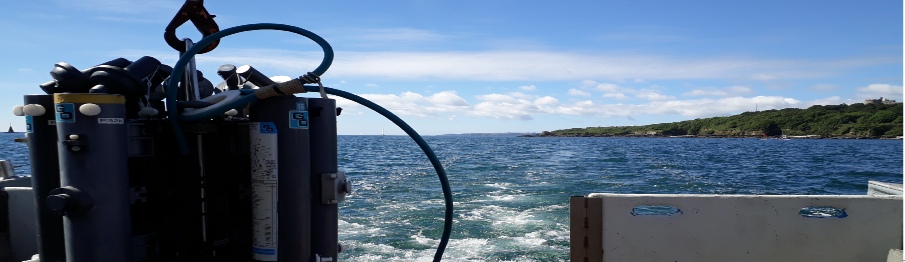
Image 1: A-Frame and winch wire used to lower CTD to depth
Image 2: CTD rosette
Figure 6: Shows turbidity fluctuating with depth for all stations. Increasing below 40m at station 13.
CTD Profiles
Physical
ADCP Transects


Figure 7: ADCP transect from station C11
Figure 9: ADCP transect from station C13
Figure 8: ADCP transect from station C12
Richardson’s Number

The Richardson number was calculated using the following equation:
This took into
account the acceleration due to gravity, overall density within the water column
and change in depth and salinity from point to point. There is a simplified equation
which doesn’t take into account shear components, this only occurred where there
were flows in opposing directions and a difference of ~45O.
Data was smoothed by sampling
every 3 depths to remove fluctuations. As you move further out from the estuary and
towards the open ocean, there seems to be a trend towards a more well mixed water
column with lowest Richardson numbers occurring the furthest out to sea and highest
numbers occurring, with all stations exceeding the critical value for Richardson’s
number of 1 at some depth. Station 9 which is closest to the estuary exhibits the
largest peak at ~22metres with a value of 900 for Ri, generally with all other data
points beyond the 0.25 critical value below ~11metres and above a depth of ~30metres.
Stations C9, C10 and C12 all follow a relatively similar trend with coinciding peaks.
Station C11 the furthest out into the ocean and away from the estuary shows a tendency
to stratification above ~12metres with it then transitioning to a mixed water column.
C13 doesn’t seem to follow any other station closely but seems to be a delayed version
of C9, C10 and C12 with its peaks occurring ~7m below. With data most similar to
the other 2 middle stations apart from the peak at ~52m which exceeds the critical
value and may indicate slight stratification.
Figure 8: The graph shows highest Ri peaks at lower depths, ~22metres, closer to the estuary in general. Followed by trends to mixing at greater depths and further out into the open ocean. At some point in the graph all stations progress through the transition zone, between 0.25-1.00 Ri.
Figure 7 shows that flow close to the seabed and at the surface is higher than that in the water column, due to frictional stress at the seabed and on the surface due to wind. Whereas current flow in the water column is lowest and is between 0 and 0.19 for the majority. With only the bottom 5-10m and top 10m showing and the higher flow resulting from friction.
Figure 8 is ADCP data taken on the RV Callista at station C11, it shows a significantly higher current flow than figure 1 showed at the surface and at the seabed, however it also between 5-15m shallower in places than the C13 station. There is also one point of very high flow just after halfway along the transect. There are also small injections of increased flow throughout the water column whilst the remainder of the water column, aside from these few points, is laminar and much lower than station C11 with the majority of the water column’s flow being 0 to 0.07.
Figure 9 shows the ADCP data recorded at station C12, this station has higher flow and so more turbulence than other stations recorded, but still has the general trend of higher flow at the surface and seabed than mid water column. There are a few points of low current flow at the start of the transect and most of the water column in the first quarter has a flow of 0.188 whilst further along the transect flow in all aspects of the water column increases towards the last quarter to the highest area of flow being in the surface waters at the end of the transect reaching ~0.4m/s.


Figure 9. Plot of chlorophyll concentration (µg/L) for all stations from the CTD data sampled on RV Callista at 5/7/17
Figure 10. Plot of O2 saturation (%) for all stations from the CTD data sampled on RV Callista at 5/7/17
There is no general trend seen in chlorophyll concentration with depth across the different stations. C9, C11 and C12 do not show much change with depth staying between about 0.7 µg/L and 0 1.6 µg/L, while C10 and C13 fluctuate greatly. C10 peaks to 5.2 µg/L at 28 m before decreasing to the same concentration as at the surface (0.9 µg/L), while C13 increases before decreasing to a minimum of 1.4 µg/L at 23 m and then increasing again. C11 and C12 both have a maximum concentration at the surface where it is about 2.4 µg/L.
At every station, oxygen saturation is highest at the surface before decreasing down to a minimum below the surface. It then increases at greater depths. There appears to be no spatial variation in this general trend, however the level of saturation changes across the stations. For example, C10 has the lowest saturation of 83% at 35 m, and at the surface C9, C12 and C13 are undersaturated with oxygen while C10 and C11 are supersaturated. All stations become supersaturated at a certain depth besides C11 & C9, where C9 O2 saturation decreases with depth where the stations lowest saturation of 85% is reached at 25m. It should be noted that C11 could well become supersaturated if samples were taken at a deeper depth.
All stations besides C9 showed little change in nitrate concentration in the top 15 – 20 m, followed by an increase below this depth up to a peak (0.6 µmol/L around 31 m for C11 and C12). At most stations, there is either no change or a slight decrease below this depth. This was the lowest depth sampled at C13. C9 is different because the surface value is very high (2 µmol/L where the other values lie between 0 and 1 µmol/L) before sharply decreasing between the surface and 15 m, where the concentration is roughly 0.3 µmol/L.
At every station, there is a general increase in silicon concentration, with the surface concentrations always being below 0.2 µmol/L. C10 is the only station to decrease below its surface concentration, but below 20 m depth it shows a consistent increase in concentration with depth. C13 and C11 show a similar trend down to about 15 m where their concentration increases steadily, while the opposite is seen at C9 and C12, where concentration increases sharply in the first 15 – 20 m to a peak before decreasing at lower depths. The peak of 1.53 µmol/L at 20 m for C12 is the highest concentration seen.
All stations show an increase in phosphate concentration with depth, but there are many fluctuations within the water column. C9 and C13 both peak at a point mid-way through the water column before decreasing slowly, but the others carry on increasing down towards the sea bed. C10 and C13 are the only stations where concentration decreases initially from the surface, the others all reach a minimum towards the surface. At the surface, phosphate concentration is approximately 0.1 µmol/L at all stations bar C10 which is higher.
Figure 11. Plot of nitrate concentration (µmol/L) for all stations from the CTD data sampled on RV Callista at 5/7/17
Figure 12. plot of silicon concentration (µmol/L) for all stations from the CTD data sampled on RV Callista at 5/7/17
Figure 13. Plot of phosphate concentration (µmol/L) for all stations from the CTD data sampled on RV Callista at 5/7/17


Figure 15 shows that a total of 110 individuals were counted which is equivalent to 110,000 cells/l with 7 species present. The most abundant species appears to be Rhizosolenia alata, making up about 45% of the total counted (50,000 cells/l).
Figure 16 shows that a total of 110 individuals were counted which is equivalent to 110,000 cells/l with 7 species present. The most abundant species appears to be Rhizosolenia alata, making up about 45% of the total counted (50,000 cells/l).
Figure 17 shows that a total of 14 individuals were counted which is equivalent to 495 per m3 with 5 types of zooplankton present. The most abundant species appear to be Copepoda Nauplii making up 43% of the total count (212 per m3).
Figure 18 shows that a total of 172 individuals were counted which is equivalent to 172,000 cells/l with 11 species present. The spread of abundances is much more even with Guinardia being the most abundant making up about 33% of the total count (56,000 cells/l)
Figure 19 shows that a total of 29 individuals were counted which is equivalent to 342 per m3 with 6 types of zooplankton present. The most abundant by far is Copepoda making up 72% of the total count (248 per m3).

Figure 20 shows that a total of 15 individuals were counted which is equivalent to 265 per m3 with 5 types of zooplankton present. Copepoda are the most abundant making up 73% of the total count (195 per m3).
Figure 30 shows that a total of 87 individuals were counted which is equivalent to 87,000 cells/l with 10 species present. Pseudo-nitzschia is the most abundant species here making up about 34% of the total count (30,000 cells/l).
Figure 14 shows that a total of 34 individuals were counted which is equivalent to 34,000 cells/l with 4 species present. The most abundant species appears to be Pseudonitzschia delicatissima, making up about 59% of the total counted (20,000 cells/l).
Figure 5 shows that a total of 52 individuals were counted which is equivalent to 52,000 cells/l with only 3 species present. The two most dominant species here are Dinoflagellates – 48% and Pseudo-nitzschia delicatissima – 46%.
Physical
The results show a trend towards stratification at 19~25metres which somewhat correlates
to the final change in temperature
and salinity to a constant temperature and salinity
throughout the deeper ocean. Most don’t peak above 10 in Richardson number however
one peaks to 100 which would almost ensure stratification here but other data seems
to not back this up. As mentioned previously all stations pass through the transition
zone meaning summer heating may have begun to impact the meeting point between brackish
water and ocean water. However, Ri was first quantified by Miles and Howard (1961)
and elaborated on by Abarbanel (1984). Another addition occurred to include two more
equations to improve the understanding by Large et al (1984) which added internal
wave breaking and double diffusion. Due to insufficient data without time series
data of a specific location it’s difficult to say whether the trends seen are a constant
feature of the water column or an irregular occurrence; Further observations would
need to be made.
The water columns sampled from more inshore stations (C9 & C10) to offshore stations (C11, C12 & C13) display an expected structure, where, surface temperature tends to increase from inshore to offshore, hence, more inshore waters are areas of mixing, whereas offshore waters are more stratified (figure 2) Whilst temperature variations are the dominant force in mixing for offshore waters, salinity has little input as seen in (figure 3). The fluorescence data (figure 1) shows a peak at ~20-30m depth for all stations, giving a good indication of the plankton abundance and thermocline depth.
Chemical
The chlorophyll data measured at stations C10 & C13 coincide well with the measured fluorescence (figure 1 & figure 9), where chlorophyll and fluorescence peak at 20-30m. On the other hand, stations C9, C11 & C12 chlorophyll data do not match well with the fluorescence, this could be due to human error in sampling or analysis. The nutrient profiles for nitrate, phosphate and silicate tend to follow an expected pattern with depth, wherein, nutrients increase with depth bar areas of high phytoplankton abundancies where there is high nutrient consumption and nutrients become limiting (figure 11,12,13 & 14 respectively.) (Tilman et al., 1982). It should be noted however, that station C9s nitrate profile shows an area of input, this makes sense due to C9 being the most inshore station that is closest to fresher riverine inputs that would be higher in nitrate. The O2 saturation data (figure 10) correlates well with the observed thermocline, where the O2 saturation is highest at the surface due to the air-surface interaction, and decreases at the thermocline where O2 is being utilised by the respiration of the zooplankton; sampling took place after the spring bloom, therefore, phytoplankton abundance would drop due to decreasing nutrients and increasing zooplankton grazing. Deeper than the thermocline however, O2 increases for stations C10, C12 & C13 and actually becomes supersaturated, this could be an error in sampling or analysis.
Biology
One of the trends in this data set appears to be that as the abundance of phytoplankton increases the abundance of zooplankton decreases. This is because of the predation cycle between phytoplankton and zooplankton and selective grazing by zooplankton alters the structure of communities of phytoplankton. Whilst, the phytoplankton structure will also, influence the dominance and composition of the zooplankton community (Karabin, 1985).
In the surface waters with depth 10-20m, shown for stations C9 and C11 the most dominant zooplankton species are the Copepoda However, at station C9 the Copepoda species abundance is lower at 33% whereas at C11 the species abundance is 72%. This could be because of increased competition for resources such as food at site C9 as shown in the pie charts as at site C9 we observed 11 different zooplankton species, where as at site C10 we only observed 6 species of zooplankton (Begon et al., 2006). As you progress down the water column the zooplankton community structure changes so at depth 20-30m the dominant zooplankton are Copepoda Nauplii and Hydromedusae which compose 40% and 30% respectively. This could be because of Copepoda being grazers and hence better food strategy for the upper water column.
| Meet the Team |
| Time Series |
| Spatial Series |