Metadata Sidescan Sonar Sediment Grabs Underwater Video Poster
On the 30/06/2014 between 0844 UTC and 1204 UTC two 2km transects were surveyed with
sidescan sonar to obtain data and imagery on interesting bedforms and sedimentology
within Veryan Bay, Cornwall. To accompany and ground-
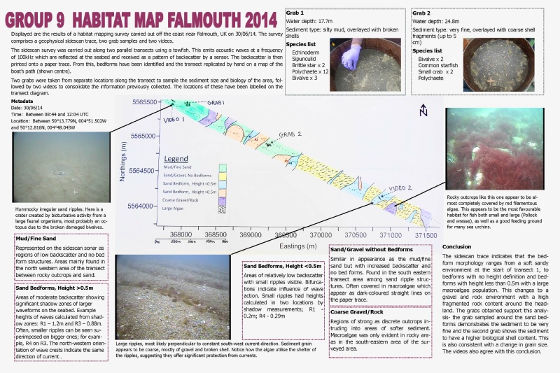
The sidescan sonar frequency used was 100kHz which was pinged at the seabed at a set interval and is then reflected back as backscatter, the backscatter received will change depending on the sediment/geomorphology at the seabed. The backscatter is then printed onto a paper trace. From this bedforms were identified and the transect was replicated by hand on a map of the boat’s path (Figure 2.0).
The sidescan sonar analysis suggested a soft, fine sediment environment with small ripples around/less than 0.5m in size. This fine sediment environment appeared to be ideal for detrital feeders such as starfish, and there was clear signs of infaunal activity and bioturbation. However, as we progressed along the transect (towards the headland) the bedform changed rapidly; the new bed form composed of mostly gravel and broken shell, this coarse grain sediment formed mega ripples with clear and deep troughs and crests. This change in sedimentology also led to a shelter for filamentous red algae growth. It was clear from the video footage that the change in sediment type also led to a change in representative organisms, and the absence of detrital feeders/infauna can be linked to preferential association with fine grained sediment of a higher surface area:volume ratio1. At the headland the geology changed again to productive rocky reefs and rocky outcrops, with coarse gravel and sand beds.
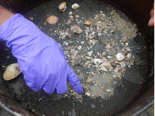
The first benthic grab was synonymous with the observed bed type of fine grain silty mud with high infaunal biomass; 19 individuals were recorded in all. The sediment from the second grab was analysed as fine to coarse with shell fragments, the faunal biomass was much less with only 5 individuals identified. The underwater video further cemented the findings from the sidescan transects and grabs.
The underwater video showed the first site to be sandy with ripples, to gravely with mega ripples. The second site was a rocky environment, with reefs and rocky outcrops. In between the rocky outcrops the sediment was mostly sand to gravel.
Figure 1.1
Google Earth image of sidescan sonar transects on 30/06/2014, highlighting position relative to the Fal estuary.
30/06/14
0844 -
Between 50°13.779N, 004°51.502W and 50°12.816N, 004°48.043W
Dry, calm weather.
0756 UTC
1429 UTC
Mud/Fine Sand
Represented on the sidescan sonar as regions of low backscatter and
no bed form structures. Areas mainly found in the north western area of the transect
between rocky outcrops and large sandy bedforms.
Sand/Gravel without Bedforms
Similar in appearance as the mud/fine sand but with increased backscatter and no bed forms. Found in the south eastern transect area among sand ripple structures. Often covered in macroalgae.
Sand Bedforms, Height <0.5m
Areas of relatively low backscatter with small ripples visible. Bifurcations indicate influence of wave action. Small ripples had
Grab 1
Water depth: 17.7m
Sediment type: silty mud, overlayed with few broken shells
Taxa present:
-
-
-
-
-
Grab 2
Water depth: 24.8m
Sediment type: very fine, overlayed with coarse shell fragments (up to 5 cm)
Taxa present:
-
-
-
Site 1
Irregular, hummocky bed of medium grained sediment transitioning into large ripples,
likely perpendicular to south-
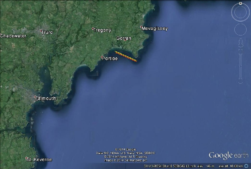
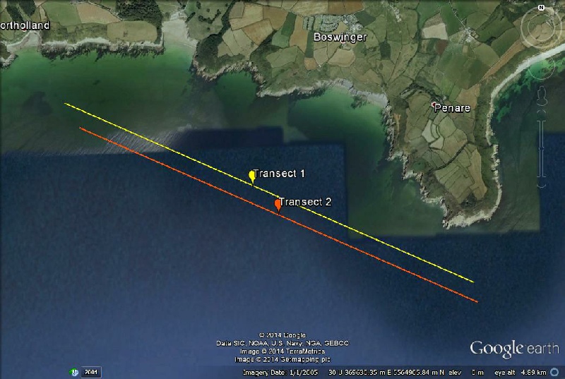
Figure 1.2
Google Earth image of sidescan sonar transects on 30/06/2014, highlighting proximity of ship track to the Penare headland.
Figure 2.0
Sediment type and bed morphology, as interpreted from sidescan sonar backscatter paper trace, following transect lines.
Site 2
The video line initially showed a rocky reef, abundant in red filamentous algae and white, filter feeding and branching sponges, , which appear to prefer to predate rocky overhangs, whereas the algae is found on the upper rock surface to maximise absorption of downwelling light. This appears to be a favourable habitat for fish both small and large (with both pollock and wrasse present), as well as a good feeding ground for numerous sea urchins.
Species/taxa present:
-
-
-
-
-
-
-
Species/taxa present:
-
-
-
-
-
-
-
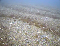
Image 4.2
Large ripple bedforms present at Site 1, at 00:03 of VTS 5.
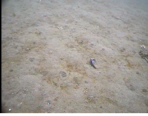
Image 4.1
Hummocky bedforms present at Site 1, at 00:08 of VTS 1.
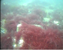
Image 4.4
Biologically rich rocky outcrops at Site 2, at 00:01 of VTS 11.
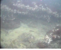
Image 4.3
Rocky reef with overlying patches of fine sediment at Site 1, at 00:08 of VTS 8.
heights calculated in two locations by shadow measurements; R1 -
Sand Bedforms, Height >0.5m
Areas of moderate backscatter showing significant shadow zones of larger waveforms
on the seabed. Example heights of waves calculated from shadow zones: R1 – 1.2m and
R3 – 0.88m. Often, smaller ripples can be seen superimposed on bigger ones; for example,
R4 on R3. The north-
Coarse Gravel/Rock
Regions of strong backscatter indicate a hard substrate. Rocky areas occurred as
discrete outcrops intruding into areas of softer sediment. Macroalgae was only evident
in rocky areas in the south-
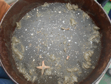
Image 2.1
Finer sediment and infauna from Grab 1.
Image 2.2
Coarser shell fragments and bivalves from Grab 2.