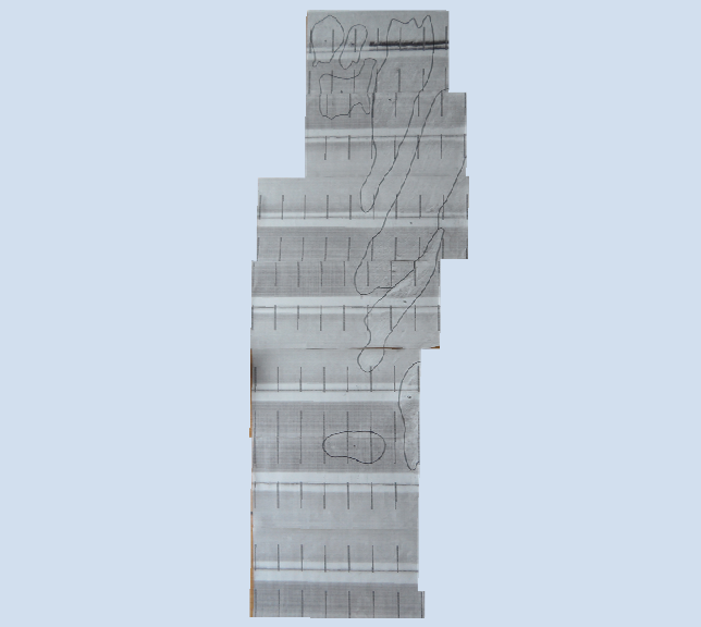
Sidescaner Trace
Conclusion
Citations
Introduction
Methods & Materials
Notes

Conditions
Date:
Time:
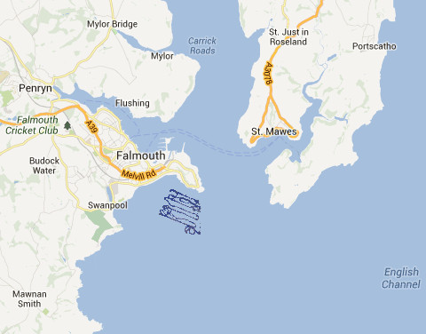
Location:
Latitude:
Longitude:
Wind Speed:
Sea State:
Cloud Cover:
Vessel:
High water:
Low water:
26/06/13
8:54 GMT
Pendennis Point
50˚08’541N
005˚02’532W
2
Calm
2/8
Viking
07:15 GMT
14:10 GMT
Introduction to the Geophysics practical
The aim of the Geophysics practical was to create a habitat map by combining multiple layers of information. Habitat maps are necessary to provide a greater knowledge of the sea bed and, in particular, areas in need of protection. This is important as conservation and management schemes require an understanding of the marine habitats in the area in which they are working. The Fal Estuary is a good example of an area in need of a detailed habitat map for multiple industries to refer to. Grab samples could not be taken due to new legislation.
Equipment used:
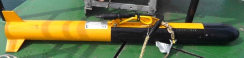
1. Sidescan Sonar
2. Video

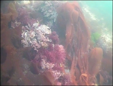
Kelp covered Rock
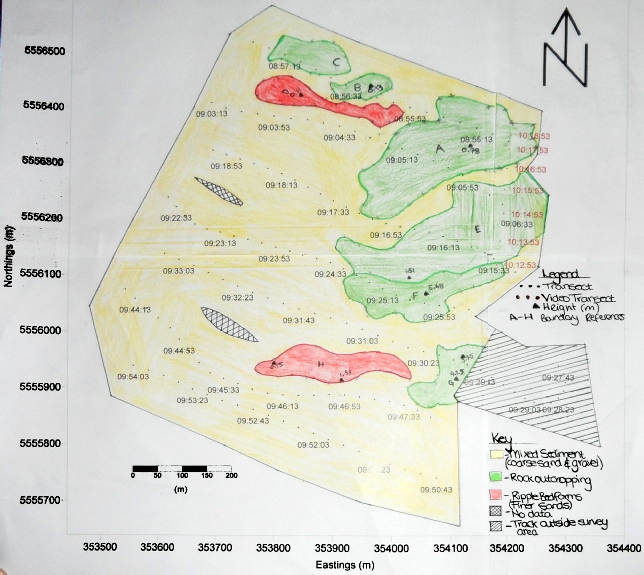
The areas identified as rock from the sidescan showed strong backscatter and shadowing with a height range of 0.78m to 5.68m. These values are greater than that of ripples. The video showed kelp in boundaries A, E and F. The holdfast of Kelp requires a hard substrate to anchor itself confirming rock as the bedform.

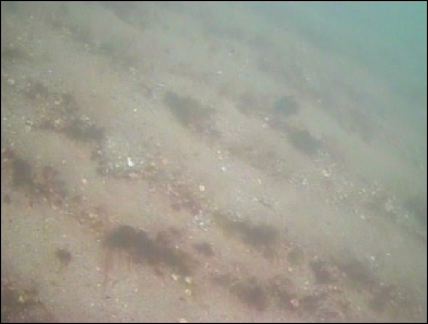
Mixed Sediments
The majority of the surveyed area was identified using a sidescan and video output, as mixed sand and coarse gravels. An Admiralty Chart of Pendennis Point was used as confirmation.

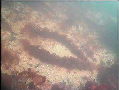
Sediment bedforms
Long straight ripples were observed in two boundaries. The ripples were observed to have identical wave frequencies of 0.86 waves per metre and heights of 0.15m. As such, it can be assumed that they were formed by low energy water column currents in mixed sands and gravels.
Citations:
[1] Hall-
[2] Langston, W. J. et al. 2006. Characterisation of the European Marine Sites in South West England: The Fal and Helford Candidate Special Area of Conservation (cSAC). Hydrobiologia 555, 321–333.
[3] Deeble, M. & Stone, V. 2009. A port that could threaten marine life in England’s Fal Estuary. Oryx 19, 74.
Notes
Small sections of the seabed were not sampled due to the research vessel drifting off course during the transects (see key)
Conclusion:
In conclusion, various mapping techniques and external references (Admiralty charts), have allowed for an assessment of the bedforms around Pendennis Point. It was established that the surveyed area showed a combination of hard substrata with kelp interactions (A, B, C, E, F and G), mixed sediment (D and H) and coarse mixed sands and gravels.
Introduction:
The Fal estuary is a site of ecological importance due to the high diversity of habitats, including maerl beds[1] and eel grasses and as such is a Special Area of Conservation (SAC)[2]. Due to this conflicting views have risen with regards to dredging plans and recent restrictions have been put in place on boat anchorages and certain scientific surveying methods. A habitat map is required to identify the areas suitable for dredging and to prevent further destruction of important habitats[3].
Materials and Methods:
- A suitable survey area was located using Admiralty charts.
- Sidescan sonar was used to create an acoustic oblique image of the seafloor, the frequencies used were 100kHz and 415kHz. Video recording equipment was towed behind the boat. Together, these were used to characterise the main bedforms and physical habitats.
- Due to new legislation, a video transect was used for ground truthing instead of grab samples.
- Seven transects were made in the area between 50˚08.446’N, 005˚02.813’W and 50˚08.420’N, 005˚02.420’W with one additional video transect (Start: 50˚08’2994N and 005˚02’4272W).
- Only a small video transect, across the edge of the sidescan transects, was taken which limited confirmation of the sidescan data. A time restriction meant multiple video transect could not be taken. More would been beneficial for identification purposes.

The views expressed on this website are those of the individuals and not necessarily the views of Southampton University or the National Oceanography Centre

