

Plymouth Field Trip 2019 - Group 1
|
Date
|
04.07.19
|
|
Start of survey (UTC)
|
09:44
|
|
End of survey (UTC)
|
13:06
|
|
Cloud cover (okta)
|
0
|
|
Seastate
|
Calm-smooth
|
|
High Tide Plymouth (UTC)
|
06:46, 5.3m
|
|
Vessel
|
RV Falcon
Spirit
|
Tamar-Tavy Estuary is located at the border between Devon and Cornwall. Notably,
it includes the confluence of the River Tamar, River Tavy and the River Lynher which
is a site of special scientific interest (SSI) (Plymouth-MPA, 2014). The lower estuary
(breakwater to the Saltmarsh) was surveyed by University of Plymouths Falcon Spirit
vessel and the upper section (Saltmarsh to Halton Quay) of the estuary was surveyed
by the Flying Pig vessel (Fig. 1).
Using data collected from both vessels, the aim of this research was to investigate
the entire estuarine system. To understand how the physical, chemical and biological
properties vary on a temporal and spatial scale. The influx of freshwater and tides
have a large influence of the partially stratified mixing process that occurs within
the estuary. Initially, the Flying Pig vessel was set to reach the lowest salinity
area located at Calstock but unfortunately due to spring tides the water depth was
too low to safely reach this area.
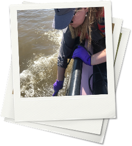
On the Falcon Spirit, 9 stations were targeted due to their varying location within
the estuary, with additional notations of habitat type and surrounding features.
On the downcast of the CTD at each station, areas of interest were noted and on the
upcast niskin bottles were fired at those heights to collect water samples in order
to analysis dissolved oxygen, chlorophyll, nutrients and phytoplankton. At a few
stations, zooplankton nets were deployed at towed to gather further data.
For the upper estuary, surveyed in the Flying Pig RIB, a multi-parameter salinity
monitor was used to create a depth profile for three locations. We measured dissolved
oxygen, salinity, total dissolved solids and temperature at each meter as well as
at the surface.

Figure 1: A map showing the stations sampled across the estuary system in Plymouth.
|
Station
|
Latitude
|
Longitude
|
|
C
|
50º23’74.3”
N
|
004º12’68.7”
W
|
|
C1
|
50º25’33.6”
N
|
004º12’25.3”
W
|
|
D
|
50º23’74.3”
N
|
004º12’63.7”
W
|
|
E
|
50º23’40.9”
N
|
004º11’94.5”
W
|
|
F
|
50°22’62.5” N
|
004°11’44.1” W
|
|
G
|
50°22’10.2” N
|
004º11’57.6”
W
|
|
H
|
50°21’50.9” N
|
004º10’13.3”
W
|
|
I
|
50°20’20.8” N
|
004º09’89.2”
W
|
|
J
|
50°20’04.1” N
|
004º08’03.1”
W
|
Table 1: shows the station locations for the Falcon Spirit sampled estuarine stations
|
Station
|
Latitude
|
Longitude
|
|
Tamar Front Side
|
50°25’75.8” N
|
004°11’89.7” W
|
|
Tavy Front Side
|
50º25’73.7”
N
|
004º11’90.0”
W
|
|
A0
|
50°27’65.2”
N
|
004º13’51.0”
W
|
|
A1
|
50º27’86.3”
N
|
004º12’78.2”
W
|
|
A2
|
50º26’96.7”
N
|
004º12’39.7”
W
|
|
B0
|
50º26’22.5”
N
|
004º11’80.1”
W
|
|
B1
|
50º25’73.3”
N
|
004º11’91.6”
W
|
|
B2
|
50º25’03.9”
N
|
004º12’32.6”
W
|
|
C0
|
50º24’32.4”
N
|
004º12’30.0”
W
|
Table 2: shows the station locations for the Flying Pig sampled estuarine stations
Pink: A0
Lime: B0
Grey: C-1
Red: C/C0
Cyan:D
Purple: E
Yellow: F
Dark blue: G
Brown: H
Dark green:I
White: J


Zooplankton
Across stations A, C and H, the most abundant zooplankton genus was Copepoda, which
dominated >80% of the zooplankton community. The highest abundance was found at Station
A with a total of 421.1 cells/m3. Additionally, this was the only station that recorded
the genus Mysidacea, however no Appendicularia spp. were observed, which were present
at Stations C and H (Fig. 2)
Phytoplankton
A variation in phytoplankton species and diversity was recorded along the estuary..
Overall, 16 different genera were identified of which the genus Lauderia dominated
the whole phytoplankton community at stations I, G, J and C-1, whereas Stations C
and F were mostly composed of diatoms of the genus Thalassiosira. Additionally, Thalassiosira
was found throughout all stations across the Tamar River (Stations C0 – A0). Furthermore,
Chaetoceros was present at most stations. A very low number of cells was recorded
at station H (3 total cells/ml) compared to the samples at the other stations which
all had >25 total cells/ml. Station B0 contained the highest abundance and diversity
of phytoplankton with 11 genera documented and a total of 141 cells/ml (Fig. 6).
The start end member phosphate concentration was 0.67
(m mol/L) at the top of the estuary where salinity was 0 psu. At salinity 20 psu
there appears to be an addition of phosphate in to the estuarine system. A potential
phosphate source was from agricultural input and fishing practices that occur upstream
(Paytan and McLaughlin, 2007). Following this addition, the phosphate concentrations
quickly decline from 0.67 (mmol/L) to 0.05 (mmol/L) over a small salinity increase.
0.05 (mmol/L) is the value of the end member. Altogether, at high salinities phosphate
concentrations decline. The nitrate start end member value was 121 (mmol/L) at 0
psu. All the nitrate concentration values are clustered together along the TDL with
2 outlying anomalies. They concentrations remain low across the salinity change from
the riverine water to Plymouth Sound. The highest recorded nitrate value was 43 (mmol/L)
at 21 psu. A source of nitrate could additionally be from agricultural influence
and surface runoff (Korda et al., 2008).
Upper Estuary
Station A0 was the furthest station upstream it has the lowest salinity measurements
of all the estuary sites. Salinity showed a large increase from 20.0 at the surface
to 22.5 at 3.5m. Temperature decreases from 25.6°C at the surface to 20.2°C at depth.
Station B0 had a surface salinity of around 25.6 which increases to 26.6 at 3.0m.
Temperature shows a decrease from 26.7°c at the surface to 25.5°C at 3.0m. Station
C0 was the furthest downstream site sampled by the Flying Pig. This site overlapped
with the area surveyed by the Falcon Spirit. It was the deepest of the upper estuary
sites with a maximum depth of 17m however the salinity monitor only had enough cable
to measure 11m. It has the highest salinity but shows the same increase with depth
from 30.0 at the surface to 31.4 at 11m. Temperature decreases from 19.5°c at the
surface to 18.3°C at 11m.
TDS is an estimate of mass of dissolved solids in the water. It mirrors salinity
closely in all three profiles. Dissolved oxygen, measured in percentage saturation,
increases slightly below the surface before dropping off dramatically at depth. It
also exhibits this behaviour at Station B0. At station C0 dissolved oxygen decreases
steadily between 0-4m and then fluctuates to the end of the profile.
The profiles all suggest that the upper estuary is partially mixed, which is consistent
with the findings of Uncles et al (1985), with a slight salt wedge structure. This
forms because the incoming sea water has a higher salinity and is colder and therefore
sinks below the warmer, fresher river water. The further upstream the samples are
taken, the lower the overall salinity as there is a greater freshwater influence,
however upstream has a greater flux over the tidal cycle (Milne, 1938). If we had
made it further up the estuary, we would have expected to find the fresh-salt water
interface at Weir Head.
Lower Estuary
Station C-1
Variation in the temperature over a depth of approximately 5m shows a change from
around 18.25˚C at the surface to approximately 17.65˚C at depth. Salinity, however,
saw an increase in salinity as the depth increases. An initial value of around 31.2
increased to 32.7 as depth increased. Here the denser seawater sits below the less
dense freshwater.
Station C
The temperature profile here varied greatly over depth. A peak of 18.6 was seen midway
through the water column at around 6.5m. Salinity also varies over the profile. The
peak value of approximately 32.47 was collected from the bottom depth, a low value
of 32.17 was recorded at around 8.2m. This shows any mixing is dominated by salinity.
Station D
The temperature remains within a 0.2˚C range, a low of 17.68˚C at 18.3m and a high
of 17.87˚C at a depth of approximately 3m. Salinity varied greatest at depths above
5m. The peak value of 32.9 came at the surface but decreased to a low of 32.64 by
4m. The location of D being at the mouth of the Lynher River will also have an effect
on the temperature and salinity values. However, the clear variation across the surface
values could suggest a higher rate of mixing as the water moves toward the seaward
endmember.
Station E
A steady decrease in temperature with depth except for a peak at around 3m and again
at 18m. Salinity follows a reverse profile with increasing salinity with depth. A
peak of around 33PSU is seen at approximately 18m. This shows a well-mixed water
column with no clear pycnocline. This could be due to the fresher warmer water being
injected by the Tamar and Lynher overlying the cooler more saline water.
Station F
Temperature has a decreasing trend with depth with a peak of around 17.6˚C at the
surface. Again, salinity shows an increasing trend with depth up to a peak of around
33.9 at 20m. Station F shows a very similar pattern to E due to the close proximity
of the two locations and no dramatic change in the inputs to the system.
Stations G
Both temperature and salinity show a small range. The water column is well mixed
and homogenous except for a peak near the surface. The outgoing tide could be bringing
warm saline water from the salt marshes out into the body of the estuary. This could
cause the peak in both temperature and salinity seen at the surface.
Station H - J
A clear pycnocline could be seen between 5-10m. Below which the water column is relatively
homogenous except for a bottom layer of cooler, slightly more saline water which
becomes more pronounced further out to sea. This is probably due to the depth of
the channel (dredged to allow for larger ships to enter the estuary) meaning the
tidal mixing forces are insufficient to penetrate the full depth of the water column
leaving the bottom layer relatively undisturbed. The seaward endmember has very little
freshwater input meaning that less mixing occurs, any mixing that does occur should
be dominated by temperature. Mixing becomes dominated by temperature rather than
salinity. Two distinct water layers are seen with a significant pycnocline at station
J.


Figure 6: Phytoplankton abundance (cells/ml) and diversity across all estuarine and
river stations sampled.
Biological
Chemical
Physical
Back to top
The upstream site A0 and B0 had the highest nutrient and plankton abundance, suggesting
that these are linked. Nutrients such as phosphate and nitrate are required for phytoplankton
growth which in turn provides food for zooplankton.
At the seaward side of the estuary, plankton abundance is lower. The increased depth
at certain stations means that tidal forcing is weaker and have reduced ability
to filly mix the water column, causing nutrient depletion. With lower nutrients,
phytoplankton and zooplankton numbers are lower and they cannot grow as efficiently.
Summary
For figure legends please scroll over the figure.
For figure legends please scroll over the figure.