

Falmouth Field Course 2017


The views and opinions expressed on this website are not necessarily those expressed by the University of Southampton or the National Oceanography Centre. They are purely representative of the authors of this website.


Introduction
Course Aims
Overall our study aimed to conduct an in depth analysis of the physical, chemical, geological and biological properties of the Fal estuary. This was undertaken through several different investigations over the course of two weeks, between 03/07/2017 and 14/07/2017. These were:
- Estuarine surveying – To evaluate estuary conditions, and to understand how they change in space and time between the upper and lower regions.
- Offshore surveying - To understand the offshore conditions and fronts.
- Geophysical habitat mapping – To analyse the sea floor and decipher any geological boundaries and features that might be present, and then to use this data along with a method of ground truthing to produce a habitat map of the chosen site.
- Pontoon time series – To investigate how the physical properties of the water surrounding the King Harry pontoon changed over short temporal scales.
Vessels
Group 8
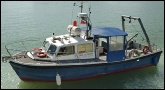
RV Bill Conway
Mid-Lower Estuary Surveying
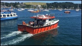
RV Callista
Offshore Surveying
Winnie the Pooh
Upper Estuary Surveying
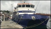
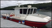
MTS Xplorer
Bathymetry
Habitat Mapping
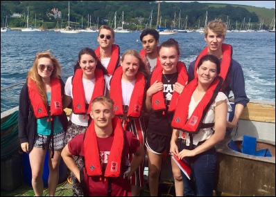
From Left to Right
Jess Caughtry, Msci Oceanography (jcc1g15@soton.ac.uk)
Alex Rushen, Msci Oceanography (acr2g15@soton.ac.uk)
Alex Bevan, Msci Marine Biology (ab39g15@soton.ac.uk)
Tom Slatter, Bsc Marine Biology (tgs1g15@soton.ac.uk)
Danielle Anthony, Msci Marine Biology (da9g15@soton.ac.uk)
Mo Saeed, Bsc Marine Biology (ms25@soton.ac.uk)
Holly Reynhart, Bsc Oceanography (hrr1g15@soton.ac.uk)
Zoe Thomas-Buffin, Bsc Marine Biology (ztb1g15@soton.ac.uk)
Alex Lee-Emery, Bsc Oceanography (adle1g15@soton.ac.uk)
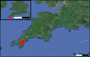
Map showing the position of Falmouth, as highlighted by the red circles. Each colour bar on the scale represents 20km and 50km for the close up and national map respectively. Image was taken using google maps [Accessed 10/07/2007].
References
DEFRA, 2015. MCZ Mearl beds. [online] Available at: http://www.jncc.defra.gov.uk/page-6023, [Accessed 12.07.17]
Pirrie, D., Power, M., Rollinson, G., Hughes, S., Camm, S., & Watkins, D. (2002). Mapping and visualisation of historical mining contamination in the Fal Estuary. [Online] Available at:http://www.projects.exeter.ac.uk/geomincentre/estuary/main/loc.htm [Accessed 12.07.17)
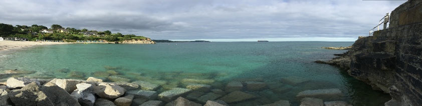
The Fal estuary is a drowned river valley that reaches the English Channel at Falmouth in Cornwall, SW England. The main tributary, the river Fal, has a catchment of mainly Devonian slates and shales, with granite dominating near the source at Pentevale. The estuary extends 18km inland (Pirrie, et al. 2002) from Pendennis Point to St Anthony Head and includes five Sites of Special Scientific Interest (SSSI) over its length.
Despite the harbour being used for both industrial and recreational purposes it remains ecologically rich, established in 2005 as a Special Area of Conservation (SAC). Of particular interest are the extensive maerl beds; a calcareous algae, normally rare in the UK but Falmouth stand as the largest area in Britain (DEFRA, 2015). Of particular interest are the extensive maerl beds; a calcareous algae, normally rare in the UK but Falmouth stand as the largest area in Britain (DEFRA, 2015). The estuary is macrotidal within the harbour (5.3m), but reduces to mesotidal (3.5m) upstream towards Truro.
| Biology |
| Chemistry |
| ADCP Transects |
| Physics |
| Biology |
| Chemistry |
| Physics |
| Sidescan Sonar |
| Video Surveys |