

Falmouth Field Course 2017


The views and opinions expressed on this website are not necessarily those expressed by the University of Southampton or the National Oceanography Centre. They are purely representative of the authors of this website.


Equipment Inventory
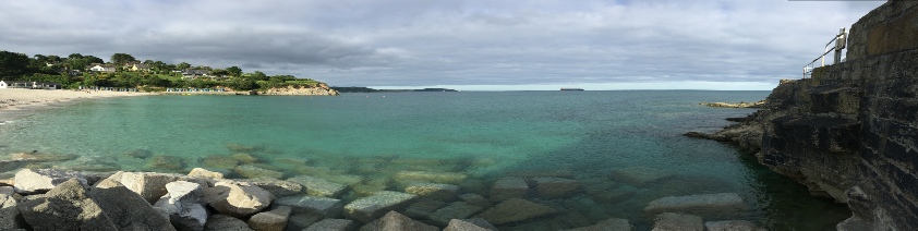
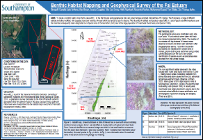
On 6th July 2017, a geophysical survey of the seafloor was undertaken to determine the geological boundaries and benthic habitats within a small area of the Fal estuary. This was achieved using a Konsberg dual frequency side scan sonar system on board the MTS Xplorer, and a submersible video camera below the boat. As the area around is considered a Special Area of Conservation (SAC), it has great ecological importance and subject to regular scientific monitoring. Its main sensitive habitat is maerl, a calcareous algae rare in the UK and in steep decline; the maerl beds growing in the estuary constitute the largest known biotope in England (UMSAC, 2001). The estuarine bedrock itself constitutes of Devonian Portscatho formations, consisting mainly of sandstone and slate, with smaller amounts of of mudstone and siltstone (BGS, 2011).
Summary
The benthic map revealed a practically homogenous seabed, with only two different types of bedrock, confirmed by ground truthing with the submersible camera. The majority of the site constituted of a muddy matrix with gravel and maerl beds. This is clear in the footage, which revealed a dense expanse of maerl covering most of the seafloor, especially at the first site, which also contained filamentous algae and a high density of Gelidium spinosum. Bleaching was also common at the first site, making identification difficult. Maerl (P. calcarcum, L. coralliodes) was far sparser at sites 2 and 3, but had a high density of suspension feeding polychaetes Sabella pavonina and macroalgae Chondrus crispus.
One possible reason could be an increase in sedimentation from one end of the site to the other. This is because Sites 2 and 3 showed a geologic boundary change and bedforms became more frequent. This correlates with the change in the ecological community as an area of high particulate influx would suit the filter feeding S. pavonina, but could smother any maerl blocking photosynthesis. This sediment gradient is also present in the upper estuary with evidence of significant China clay inputs (Langston, et al., 2003) that can smother biological activity. However, further sampling would be required to confirm anything as we only collected limited amounts of data.
Overall the benthic mapping revealed the area to have only one boundary change between different geologic constituents, and a rich and varied ecosystem, including very rare maerl beds.
References:
UMSAC. (2001). Synopsis of Maerl Distribution in Europe and the UK. Retrieved July 08, 2017, from United Kingdom Marine Special Areas of Conservation: www.ukmarinesac.org.uk/communities/maerl/m1_2.htm
British Geological Survey , 2011. Marine SeaBed Sediment Map - UK Waters. [Online]
Available at: http://www.bgs.ac.uk/products/offshore/DigRock250.html
Langston, W.J., Chesman, B.S., Burt, G. R., Hawkins, S. J., Reedman, J., & Worsford, P. (2003). Site Characterisation of the South West European Marine Sites. Fal and Helford cSAC. Plymouth Marine Science Partnership. Retreived July 13, 2017
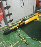
Sidescan Sonar
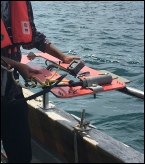
Submarine Video Camera
Habitat Map


Introduction
Metadata
Date: 06.07.17
Time: 12:00-15:30 UTC
High Water: 03:13, 15:36
Environmental conditions:
- Cloud cover 1/8
- Sea State = calm
- No rain
Tidal State: Neap flood tide
Vessel: MTS Xplorer
Select pictures for more information

| Biology |
| Chemistry |
| ADCP Transects |
| Physics |
| Biology |
| Chemistry |
| Physics |
| Sidescan Sonar |
| Video Surveys |