Home Laboratory Protocols Offshore Estuary Pontoon Habitat Mapping

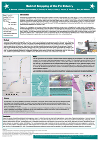
This section of habitat mapping of the Fal Estuary and the Fal river took place on the 27th of June.  Four Sidescan transects were taken, with two transects in parallel covering a segment of the upper estuary, and two along the river, a longer transect covering the river from its mouth in the estuary to further up river (shown on figure 1 and 2) the second shorter river transect was not used as the data was corrupted and lost. A Van Veer sediment grab and a video camera were used for ground-truthing.

The estuary chart data showed that the area covered was relatively flat with a range of 0.7m between the highest and lowest points in the surveyed area. Chart datum also suggested that the sediment type that was present was mud, sand and shells1.

The river would likely prove to be harder to Sidescan, as there are several bends, and from prior boat expeditions to the region, the water would be filled with particulate matter. At the surface there would be many obstructions such as pontoons, buoys, mussel farms at the surface which may interfere, and a ferry in the path that could affect the transect.


Methodology

Home

To provide a large scale picture of the region on a short timescale, a Subsurface Duel Frequency Analogue Sidescan Sonar with a 150m swath was used. It provided a general overview of the area, however, the analysis of the resulting sidescan plot was open to interpretation. As objects at the surface and in the water column could potentially affect the sidescan, all passing boats, buoys and other significant objects were recorded and noted on the sidescan.

Ground-truthing was used to verify the features present on the sidescan. A video probe and a Van Veer grab were used to ascertain the species present and establish the sediment in the habitat. The video probe was deployed to determine whether or not a grab was viable of the sea bed, and overall to build a better picture of the habitat overall.

Due to the turbidity and the particulate matter in the water column visibility was reduced. This was outlined as a possible problem in a previous expedition to the area, and turned out to be an issue on the day. There was also significant cloud cover, which further affected visibility. With the reduced visibility and variable current velocity, there was a further complication with determining the probe’s proximity to the sea floor.

Once a suitable location had been determined, the Van Veer Sediment grab was deployed. The grab was useful in determining the sediment size and composition, as well as the organisms living within it. However, the closing mechanism on the grab can disturb the sediment, or it may trigger prematurely, not taking a sample.

Upon returning from the excursion, the sidescan trace was analysed and marked with boundaries around sections of similar levels of backscatter. Using the Surfer 8 software, and the navigational data recorded in OSGB 36 format, the sidescan boundaries were overlayed onto a larger plot. The organisms present were documented using the video recording, water column conditions were noted and percentage coverage of the sea floor were ascertained at regular time intervals.


The estuary transects showed a homogenous section, with little variation in backscatter. There were some darker segments, however, they did align with buoys and boats previously noted.

One sediment grab was taken in the estuary, and several fauna were identified. The velvet crab (Necora puber), ragworms (Nereis diversicolor) the slipper limpet (Crepidula fornicata) and a type of scallop that could not be further identified, were found. The organisms found were typical for the area. The sediment recovered coincided with the chart datum, and was typical for the estuary – muddy, with fine grain size.

The riverine transect was relatively varied, with a range of substrates. There was a large amount of interference from buoys, chains, pontoons and a ferry. The river sidescan trace was divided into zones of distinct substrate types, such as fine and coarse, as well as rocky outcrops, mussel beds and possible vegetation. However, due the lack of ground truthing in these areas, the zones suggested are inferred rather than determined through ground truthing.

Due to the location of a ferry across the river a transect had to be interrupted. It was then restarted further upriver, recording down to the estuary. Secondly due to time limitations only one sediment grab was taken, and had more time been available repeat grabs would have been taken.

4 sets of videos were taken, with Video 1 and 2 taken at Site 1 in the estuary (183356.0E, 37466.6N and 183308.1E,37570.0N) in one of the recorded estuary transects. Video 3 was recorded at site 2 upriver (184311.5E,40101.0N) and Video 4 near the pontoon (184242.5E,39294.6N). Video 1 and 2 were taken at similar spots at Site 1, and as the water column was clearer it was much easier to identify organisms and megaflora. At Site 1, coverage of the sea floor by macro algae ranged from 50% to 100%, but overall was around 70% coverage. Shells were also seen in the sediment, typical of that segment of the estuary. A large amount of fauna and flora were recorded in figure 3.

Video 3 which was taken upriver had low visibility, with large amounts of particulate matter in the water column, but the river bed was recorded.  Coverage was from 5% - 10% of macro algae, and no organisms were able to be recorded either in the water column or on the river floor. The sediment looked coarse, which would be accurate considering that the water currents were high which would have carried finer material away. Video 4 wasn’t able to reach the bottom, and so has no information it at all.

Overall the estuary was how we predicted it to be, a large homogenous habitat of similar grain size, with a large range of fauna and flora. The river was more unknown before setting off, apart from a knowing that it would have a higher water velocity and a large amount of particulate matter in the column which was correct on the day. There was a greater range of substrate on the side scan track, and a significant drop in macro-organisms and viewed organisms in comparison to the estuary.


References

[1] UKHO (2000) ‘Admiralty Leisure Folio Area 4:Falmouth to Plymouth’, Taunton, UKHO

Data

Location Purpose

Start Time (AST)

Position in water

End Time (AST)

Position out of water

Transect 1

08:20:20

50°11'22.47"N

08:29:16

50°12'13.91"N


5° 2'2.79"W


5° 2'15.77"W

Transect 2

08:30:45

50°12'13.40"N

08:38:54

50°11'23.95N


5° 2'20.20"W


5° 2'7.64"W

Transect 3

09:23:01

50°13'29.67"N

09:42:02

50°12'5.24"N


5° 0'59.01"W


5° 2'26.80"W

Grab 1

10:40

50°11'52.80"N

N/A

50°11'52.80"N


 5° 2'15.90"W


 5° 2'15.90"W

Video 1

10:05

50°11'50.91"N

10:11

50°11'50.91"N


5° 2'12.97"W


5° 2'12.97"W

Video 2

10:13:37

50°11'53.92"N

10:18:06

50°11'54.19"N


5° 2'16.6"W


5° 2'15.59"W

Video 3

11:02:24

50°13'17.34"N

11:06:13

50°13'17.34"N


5° 1'30.22"W


5° 1'30.23"W

Video 4

11:13:14

50°12'56.06"N

11:17:22

50°12'56.06"N


5° 1'30.22"W


5° 1'30.22"W


Site 1

Species

Video 1

Video 2

Ulva lactuca

1

2

Linneaus furcellaria

1


Lumbicalis saccharina


1

Palmaria palmate


1

Callophyllis laciniata

1

1

Enteromorpha lunza

1

1

Gracilaria verrucosa

3


Furcellaria lumbrucalis

1

1

Porphyra umbilicalis

1


Calliblepharis ciliate

1


Dictyata dichotoma

1


Gigartina stellata

1

2

Asparagopsis armata


1

Halarachion ligulatum


1

Coriallina officinalis (bleached)


1

Nitophyllum punctuation


1

Corallina elongate ellis


1

Laminaria saccharina


1

Results & Discussion

Introduction

HOME

Laboratory Protocols

Offshore

Estuary

Pontoon

Habitat Mapping


Please download the above habitat mapping poster PDF.

Final Poster.pdf

The views expressed here are not necessarily those of the University of Southampton, National Oceanography Centre or Falmouth Marine School.

Back to top