Jessica Butland
Bsc Marine Biology with Oceanography
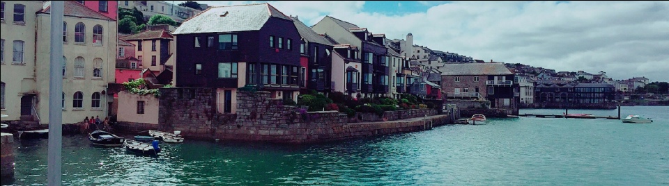
The Fal Estuary is the third largest natural harbour in the world, and is located on the South coast of Cornwall. It is classified as a drowned river valley system, also known as a ria, which was formed during the Holocene at the end of the last glaciation1. The Fal Estuary has a shoreline of 127km; that extends from the estuary mouth at Carrick Roads, to Truro, with a total area of 2500km2 and has 6 major tributaries, consisting of 70% subtidal mudflats, 26% intertidal mudflats and 4% supertidal saltmarshes2. The maximum tidal limit starts at the Carrick Roads and ends 18.1km inland at Tresillian. Carrick Roads has a spring tide range of 5.3m which decreases up the estuary to 3.5m at Truro2.
The Fal is important both economically and recreationally and is one of the county’s
busiest harbours that sees between 4000-
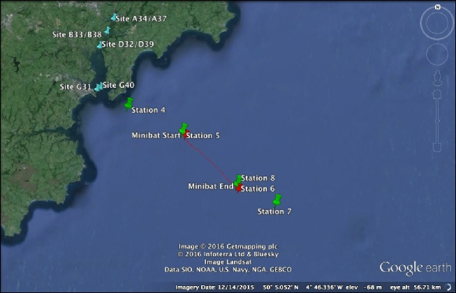
The aim of this study was to investigate the biological, chemical and physical changes within the Fal Estuary, sampling areas from the top of the Fal river to sites offshore. This study was carried out through boat trips offshore, within the estuary and from the King Harry Pontoon. The four survey methods included;
- A habitat survey from within the estuary on board MTS Valancia, looking at the seabed habitat communities using a side scan sonar towfish along fixed transects and a using a van veen grab.
- An offshore survey on board R.V. Callista, which looked at the extent of stratification from the Black Rock (estuary mouth) towards E1 (an offshore bouy).
- An estuarine survey within the Fal estuary onboard R.V. Bill Conway, which looked at estuarine mixing by carrying out horizontal and vertical transects.
- A pontoon survey from the King Harry Pontoon, which allowed a time series to be taken
over a 3-
hour period, looking at the physical properties of the upper estuary.
The Marine Biologists
The Oceanographers
[1] Stapleton, C. & Pethick, J. (1995) The Fal Estuary: Coastal Processes and Conservation. Report to English Nature, Institute of Estuarine and Coastal Studies, Hull.
[2] Hughes, S. H. (1999). The geochemical and mineralogical record of the impact
of historical mining within estuarine sediments from the upper reaches of the Fal
Estuary, Cornwall, UK. Fluvial Sedimentology VI. 28, 161-
[3] Cornwall County Council , 2006. Environmental: Code of Practice for the ports of Falmouth, Truro & Penryn. Cornwall: Cornwall County Council.
[4] JNCC, 2015. Maerl beds. [Online] Available at: http://jncc.defra.gov.uk/page-
Hannah Connabeer
Msci Marine Biology
Jacob Harper
Msci Marine Biology
Zoe Pearson
Msci Marine Biology
Jasmine Alexandria Rose
Bsc Marine Biology
Rowan Bernard
Msci Oceanography
Aleksandra Driscoll
Bsc Oceanography
William Field
Msci Oceanography
Arun Gahir
Msci Oceanography
Mairin Williams
Msci Oceanography

The views expressed here are not necessarily those of the University of Southampton, National Oceanography Centre or Falmouth Marine School.