On the morning of Tuesday 23rd June 2015 between 07:15 UTC and 11:00 UTC a habitat survey was conducted in the St Mawes Harbour, Cornwall (50°09’04.76”N, 005°00’58.39”W). A dual frequency sidescan sonar towfish was used, with 410 and 100KHz frequencies. The survey was done over three 600m transects on the south side of the estuary. High tide was at 9:20 UTC, low tide was at 15:50 UTC.
The aim was to produce a benthic habitat map in St. Mawes Harbour by identifying how the seafloor changes and how this affects the abundance and distribution of species in the estuary. A video sledge was used to receive images of the seafloor in order to ground truth the side scan trace and to identify local species. The weather was fine with overcast conditions developing later in the morning. Cloud cover changed from 2/8 to 6/8, coinciding with a small worsening in sea state from a 1 to a 2 and an increase in wind from 1 to 3 on the Beaufort scale. This deterioration in sea state was insufficient to significantly affect data quality.
It was not possible to calculate bedform heights for the bedrock present on the edge of the side scan trace as the shadow length extended beyond the swath’s range. Furthermore, as the surveyed site is located in a designated SAC it was not possible to perform a grab, thus grain size of the substrate is not known.
A Subsurface Dual Frequency side scan sonar (Figure 1.1) running at 410 and 100 khz (deployment shown in picture (Figure 1.2); remotely mapped the seafloor along 3 different transects. The 100 khz printout was used to create the map (Figure 1.3)
Habitat 1 (Seagrass):
Mainly Eelgrass (Zostera marina) forming a nursery ground for local fish species (Heck et al., 2003)
Habitat 2 (Sandy substrate):
Sandy with various other features contained e.g. rocks, seagrass & algae.
Habitat 3 (Bedrock):
Located closest to the harbour shoreline and consisted mainly of rocky outcrops, the tops and outline of which were also visible from the surface. From observations of nearby similar environments kelp is presumed to grow here.
Habitat 4 (Isolated Sand):
Soft sandy sediment isolated by seagrass beds.
Video imaging was used for ground truthing on the 1st transect to provide better
understanding of the benthic habitat and organisms situated there. It passed through
habitat 1 and along the boundary of habitat 4. Screen shots of this can be seen in
figures 2.1 -


Figure 1.1: Subsurface Dual Frequency side scan sonar
Figure 1.2: Deployment of Subsurface Dual Frequency side scan sonar
Figure 1.3: Habitat map constructed from side scan sonar data.
The views and opinions expressed on this page are those of Group 3 and do not represent the views of the University of Southampton, the National Oceanography Centre or Falmouth Marine School.


Figure 2.1: Screen shot from video imaging of unidentified Ascidean.
Figure 2.2: Screen shot from video imaging of Sepia officinalis.
Figure 2.3: Screen shot from video imaging of Arenicola burrow casts.
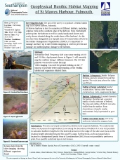
A poster was also made. This can be viewed in full by clicking on the image on the right.


St Mawes Harbour
- Confirmed the presence of eelgrass (Zostera marina) beds on the southern side of St. Mawes Harbour using sidescan sonar techniques.
- Using sidescan sonar techniques and using a camera drag to ground truth, the presence of an isolated area of soft sand inside the eelgrass beds was confirmed.
- Several species were documented including Zostera marina and Sepia officinalis.
References:
Heck Jr., K.L., Hays, G., Orth, R.L. (2003). Critical evaluation of the nursery role
hypothesis for seagrass meadows. Marine ecology progress series. Vol. 253. Pp: 123-