
Falmouth Group 4
23rd June- 6th July 2013

Pontoon
Introduction
The King Harry Pontoon is situated approximately 3.5 nautical miles from Falmouth Docks. This location meant that the tidal properties of the river could be explored in order to highlight changes in the tidal cycle over both short and long time scales. Data such as light attenuation using a light meter and secchi disk readings, current speed and YSI probe data including temperature salinity and oxygen saturation define key factors which could differ over time.
Light levels at the surface and then 1m intervals were measured using a light meter; calibration data was taken with both sensors at the same height above the water. Then one sensor was lowered at 1m intervals until the maximum depth whilst one remained above the surface in order to determine the ratio between surface light levels and the decreasing light levels with depth. A secchi disk was also used to measure light penetration depth and determine the depth of the euphotic zone. The disk was lowered over the side of the pontoon and the depth where the disk was no longer visible was recorded.
Temperature, salinity, dissolved oxygen and pH were measured using an YSI probe lowered at 1m intervals until the maximum depth. A current meter was used to measure velocity and orientation of flow down the estuary. Flow measurements were taken at sub surface and at 1m depth.
Figure P1 displays the ratio calculated from the pontoon light sensor data. Looking at the figure there is an obvious difference in the light levels during the morning, with the first reading - taken at 08:35UTC - having a visibly different curve to the rest of the data. The tide when the measurements were taken was still rising, with high water expected at 10:31BST (09:31UTC) with a tidal range of approximately 3.9m at Falmouth Docks. Due to the distance between the tidal point and the pontoon a lag occurs before high water is reached at the pontoon. This could explain why the results do not follow an exponential log trend until 10:05UTC. By 11:35UTC there are deviations from the expected curve again.
Looking at Figure P2, there is deviation away from the trend line which is supported by Figure P1 as it did not follow a normal exponential curve. All of the data was within a range of 0.4 however the gradient does not remain constant. The gradient range is 2.1, between -3.0 and -5.1. This shows that the environment was dynamic. When compared to the vertical profiles for salinity in Figure P3, it suggests that the salinity developed to become well mixed over the duration of sampling. This suggests that during the ebb tide, mixing processes increased due to the decrease in water depth as it flowed out of the estuary. Higher salinities were recorded during the first samples at the pontoon; this coincides with the input of saline water during the flood tide before high water at 09:31UTC. The lag between high water at King Harry and Falmouth Docks is clearly seen at 09:35UTC-10:05UTC. This is calculated to be approximately 8 minutes behind the tidal peak at Falmouth Docks meaning it would have occurred at approximately 09:39UTC. The salinity decreases over the time series due to the increased freshwater input during the ebb tide, most notably at 12:05UTC.
The pontoon data agreed with the conclusion of the estuarine data, which is that the estuary is well mixed. This is apparent at the higher end of the estuary with the relatively stable vertical profiles through a flood stand and ebb tide. This has been supported by the temperature and salinity profiles (figure P3 and figure P4) which demonstrate only a slight trend, with environmental factors also playing a big part.
The data was collected to examine the tidal influence on the upper estuary. This was measured through the parameters; light attenuation (using a light meter and secchi disk readings), current speed and YSI probe data including temperature salinity and oxygen saturation
Aims and Objectives
Looking solely at the attenuation coefficients calculated from the secchi disk, it shows that the attenuation was largest at 12:05UTC, although there was only a 0.05 difference between 09:35UTC and 12:35UTC. This suggests that the water quality became relatively stable by 09:35UTC which would is close to the tidal peak. It remained stable over the rest of the period sampled.
Initially, Figure P4 profiles are cooler as there is a delay between sun rise and incoming solar radiation having an influence on the surface waters. This means that most of the change in temperature is not due to the flood/ebb tide present, but instead a result of increased solar radiation. The temperature rise at the surface is approximately 1.4˚C whereas at the benthic interface we see an increase of approximately 0.7˚C. This supports the suggestion that solar radiation is a key influencing factor. At 08:35UTC the range from surface to depth is 0.4˚C whereas at 11:35UTC the range is 1.7˚C. However, the range is lower if the measurement is taken from the benthic interface, with a lower temperature recorded at 4.5m suggesting that there is a bottom current possibly caused by friction.
Combining the results from Figure P3 and Figure P4 allow the density profiles in Figure P5 to be calculated; demonstrating that despite an increase in temperature, the decrease in salinity has an overriding effect as density decreases over the 3.5hour period sampled. 11:35UTC shows the largest variation over the sample period, density changes from above 1024.5kg/m3 to below 1025.9kg/m3. This shows a variation of 1.4kg/m3 whereas at the most constant time the variation can be as low as 0.5kg/m3 (08:35UTC).
There is little movement in the main water column during the final time remaining before the tidal peak. As shown in Figure P6, the majority of the movement occurs in the middle 6 hours of the 12hr 25minute tidal cycle. The rule of 12ths confirms that this is expected behaviour (Goode, 2012). Figure P6 shows that despite the turn of the tide between 09:35UTC and 10:05UTC the direction of the water column at 1m depth does not change. The data from the surface was a little unreliable, leading to the decision not to include the direction for this data. This unreliability may have arisen from the current meter being used at an insufficient depth to provide accurate readings or may have been influenced by its proximity to the pontoon edge. Furthermore, recordings at the surface may have been adversely influenced by the YSI probe which was located approximately 1m upstream of the current metre.
Figure P7 shows the pH values initially increase before reaching a maximum alkalinity at 10:05UTC before becoming more acidic, reaching the lowest alkalinity at 12:05UTC. The difference at the surface is 0.1pH and at depth is 0.6, although there is a lower alkalinity in the water column at 11:35UTC where it reaches 8.24. The values do not remain constant, with fluctuations consistently present in the column. The values are always more alkaline at the surface than in the water column or at depth.
Oxygen saturation - shown in Figure P8 in percentage for - illustrates the changes in saturation within the water column over time. The saturation is lowest at 08:35UTC with the level being stable throughout the water column, whereas at 10:35UTC it has a surface saturation of 128% but decreases to less than 114% at 5.5m. This is the largest variation of saturation over the 3.5 hours sampled, with the highest saturation throughout the entire column at 11:05UTC. This suggests an increase in mixing processes, or input of well mixed water, which correlates with the fact that the tidal peak will have occurred between the 09:35UTC and 10:05UTC. This will have led to an increase in saline, well mixed water from the estuary and surrounding off shore waters.
Using the parameters measured and displayed in Figure P5, P6 and gravity, whilst assuming that the maximum depth of the place that is measured is 6m (which was confirmed during the practical). Figure P9 shows that the estuary has a laminar flow, as the figure is above 1 at 09:05UTC onwards. Although the point at 08:35UTC is below 1, it is above 0.25 which is the critical lower limit for turbulence to occur.
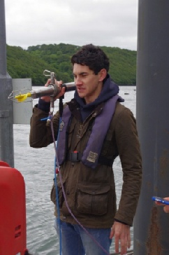
Table P1 shows the attenuation co-efficient calculated from the secchi disk measurements (calculated as 1.44*secchi measurement) and the attenuation coefficient calculated from the sensor data (calculated as ǀ1/gradient of log valuesǀ) (Purdie, 2013). This shows that there is a significant difference of up to 130% increase. The difference could be due to the position of the light meter on the pontoon; shadows could have played a significant role in altering the readings that the subsurface light sensor produced. As a result, secchi disk readings are likely to be more accurate and consequently the ones used for analysis. These results may have been affected by surface glare making visibility of the secchi disk more difficult to determine with the human eye. However, this should have had a lesser effect than the shadows on the light probe.
Current Meter
References:
Goode J. (2012) How to work out Tidal Heights, Yachting Monthly.
Accessed 04th July 2013
Purdie D. (2013) SOES 2006 lecture. University of Southampton.
Attended April 2013
Personal views and information calculated on this page cannot be affiliated with the University of Southampton or the National Oceanography Centre, Southampton.