University of Southampton has been running a 2-
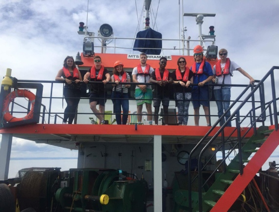
The field course was run from the 3rd of July 2017 to the 14th of July with all data, key findings and methods of survey documented within this website.
The Falmouth estuary is an important site to study due to its industrial, recreational and conservational uses. The Falmouth field course has been running for the previous 12 years forming an extensive archive of recorded biological/physical/chemical data. This archive of surveys could provide insight into observing any variations over a long time period and would be crucial in forming predictions of how this system and other similar estuarine systems might change over time.
Meet The Team
Louise Bolland
Bsc Oceanography
lrb2g15@soton.ac.uk
Joshua Doran
MSic Marine Biology
jcd2g15@soton.ac.uk
Alice Handley-
MSic Oceanography
aehh1g15@soton.ac.uk
Frej Gustavsson
Bsc Marine Biology with Oceanography
fg1g15@soton.ac.uk
Joshua Modern
MSic Marine Biology
jm25g15@sotonac.uk
Himoonga Muloongo
Bsc Marine Biology with Oceanography
hm7g15@soton.ac.uk
Theo Murphy
MSic Marine Biology
tm10g15@soton.ac.uk
Disclaimer: All the opinions expressed in this site are that of group 14 and not necessarily the University of Southampton or the National Oceanography Centre, Southampton.
References
[1]Projects.exeter.ac.uk, (2015) Available at: https://projects.exeter.ac.uk/geomincentre/estuary//Main/loc.htm
[2] Pirrie, D. Power, M. Rollinson, G. Camm, S. Hughes,S. Butcher, A. and Huges,P. (2003). The spatial distribution and source of arsenic,copper, tin and zinc within the surface sediments of the Fal Estuary, Cornwall, UK. Sedimentology. Vol.50.Pp:580
[3] Nesbet,E. (1990). The end of the ice age. Journal:Canadian Journal of Earth Sciences. Vol. 32(10).Pp: 1
[4] Langston, W., Chesman, B., Burt, G., Taylor, M., Covey, R., Cunningham, N.,
Jonas, P. and Hawkins, S. (2006). Characterisation of the European Marine Sites in
South West England: The Fal and Helford Candidate Special Area of Conservation (cSAC). Hydrobiologia,
555(1), pp.321-
[5] Farnham, W.F, Bishop, G.M, (1985), ‘Survey of the Fal Estuary, Cornwall’, Progress
in Underwater Science, 10, 53-
[6]Naturalengland.org.uk, (2017) Available at: https://designatedsites.naturalengland.org.uk.uk/Marine/MarineSiteDetail.aspx?SiteCode=UK0013112&SiteName=fal%20and&count yCode=&responsiblePerson=&SeaArea=&IFCAArea
[7] www.mba.ac.uk Available at :
http://www.mba.ac.uk/nmbl/publications/charpub/pdf/Fal_Helford.pdf
Gabriella Panteli
Bsc Oceanography
gp3g15@soton.ac.uk
The Fal Estuary Region and Geography
The Fal Estuary is located on the South coast of Cornwall and is not only the country’s largest estuary but also the third largest natural harbour in the world. The estuary has a total shoreline length of 127km and covers an area of 24.8km2. [1]
The estuary was formed in response to the Holocene sea level rise [2] approximately
12,000 years ago [3] which led to the formation of the ria which includes the Fal
estuary. The estuary is macrotidal at Falmouth, with a maximum spring tide of 5.3m
however the tidal range varies to mesotidal at Truro. The tides are semi-
The estuary is comprised of 6 tributaries as well as 28 minor creeks and river which in total lead to the main body, called Carricks Roads. All of which will affect the nutrient concentrations within the estuary.
The Fal Enviroment
The Fal consists of extensive mudflats, sandy shores and some area of salt marshes [4]. The site has been a designated SAC (special area of conservation) since 2005. It’s qualifying features include: maerl beds, estuaries, Atlantic salt meadows, large shallow inlets and bays, mudflats and sandflats not covered by seawater at low tide, reefs, sandbanks that are slightly covered by sea water all the time and Shore dock. [5] It comprises a total of 8 different component sites of Special Scientific Interest. [6]
Anthropogenic Influences
Falmouth estuary is known as a Special Area of Conservation due to the various types of habitats found in this area which includes; Maerl beds, mudflats, saltmarshes, rocky shores, eelgrass beds and oyster beds due to the shear diversity of the habitats this site is of unprecedented scientific significance.
Before its significance was understood there were large anthropogenic impacts threatening these areas such as; mining of metalliferous deposits which include, copper, lead, iron and other minor metals, after the closure of these mining sites the contaminants have spread from the initial area of deposition in Restronguet Creek, the most metal polluted estuary in the UK, to adjacent creeks such as Pill [7] (Bryan and Langston, 1992). Another impact is the large industry that surrounds the Falmouth estuary due to the docks and marinas; activities such as dredging, sewage, and oil, but the biggest is still from residual draining of old mines, spoil heads and groundwater which will significantly alter the sedimentary geochemistry.


Figure 1. Map of all Stations sampled throughout field course
You can click on all images and graphs to enlarge