DISCLAIMER: The words and views expressed here solely represent the findings made by this group and by no means those of the University of Southampton.
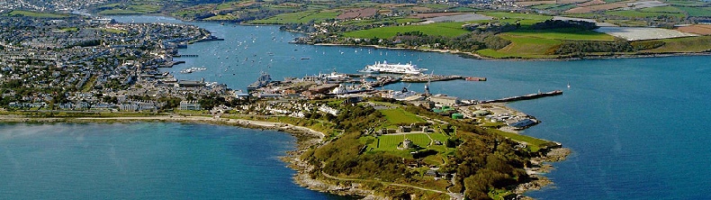
© www.visitfalmouth.com
References:
Stubbles, S (1993). Recent benthic Foraminiferida as indicators of pollution in Restronguet Creek, Cornwall. Proceedings-Ussher Society, 8.1, 200-204.
Maier, G., Nimmo‐Smith, R.J., Glegg, G.A., Tappin, A.D. & Worsfold, P.J. (2009). Estuarine eutrophication in the UK: current incidence and future trends. Aquatic Conservation: Marine and Freshwater Ecosystems, 19.1, 43-56.
Langston, W.J., Chesman, B.S., Burt, G.R., Hawkins, S., Readman, J.W. & Worsfold, P.J. (2003). Characterisation of the South West European Marine Sites: The Fal and Helford cSAC. Occasional Publications of the MBA, 8.1.
Bryan, G.W. & Gibbs, P.E. (1983). Heavy metals in the Fal estuary, Cornwall: A study of long-term contamination by mining waste and its effects on estuarine organisms. Occasional Publication of the Marine Biological Association, 2.1
Exeter University . 2015. Location of the Fal estuary. [ONLINE] Available at: https://projects.exeter.ac.uk/geomincentre/estuary/ Main/loc.htm. [Accessed 28 June 2016].
The Fal Estuary in located in the county of Cornwall, South-West England. It has an area of 24.8 km2, which is dominated by a tidal basin known as the Carrick Roads. The Fal estuary is considered the third largest natural harbour in the world. The maximum tidal height ranges from 5.3 m at Falmouth to 3.5 m at Truro (Exeter University, 2015). Six tributaries, notably the Rivers Truro and Fal, and twenty-eight other minor rivers supply the estuary. The Fal is a ria and was formed by the flooding of a river valley at the end of the last ice age, approximately 11,000 years ago.
There have been issues in the past as a result of the relatively large anthropogenic presence in the local region, which includes shipping, mining and mussel aquaculture (Bryan & Gibbs, 1983). The 1992 Wheal Jane mine incident caused heavy metal pollution in Restronguet Creek, which is still detectable in the sediment today (Stubbles, 1992). The majority of the catchment area of the Fal estuary is laid to agriculture and there have been past enrichment problems related to the leaching of nutrients (Maier et al., 2009). Areas, such as the seagrass and maerl beds, are important for a number of flora and fauna. As such, the Fal and Helford estuaries are designated as a Special Area of Conservation (SAC) and are protected under law (Langston et al., 2003).
Sampling was carried out between the 21th June 2016 and 1st July 2016. The aim of the study was to compile a comprehensive dataset regarding the key physical, biological and chemical parameters both within the Fal estuary and offshore of the region. RV Bill Conway was used to collect these measurements in the Fal estuary. A similar survey was carried out offshore using RV Callista. A time-series of similar variables was measured at King Harry Pontoon, which is located within the upper reaches of the estuary. Furthermore, an area of Falmouth Bay was mapped using sidescan sonar, video cameras and a Van Veen grab deployed from MTS Valonia. A report upon each of these activities can be found within this website.
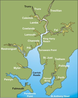
© https://projects.exeter.ac.uk/geomincentre/estuary/Main/loc.htm
Figure 1: map of Falmouth Bay and significant landmarks surrounding it.