
Disclaimer: The views expressed in this website are not those of the University of Southampton or the National Oceanography Centre

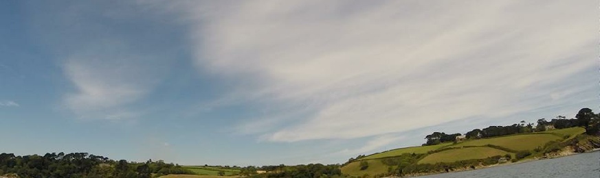
The Fal estuary, located in the South-
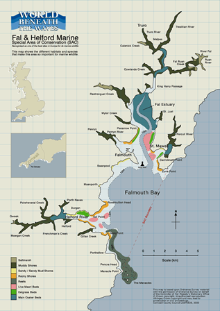
However, not only does the Fal estuary have unique topography, it is also one of the first marine SACs (Special Area of Conservation) due to its great biological diversity. There are a wide variety of marine habitats throughout the estuary, such as salt marshes, mud flats and even eel grass beds in the Helford. These eel grass beds are an SSSI (Site of Special Scientific Interest) and sustain a wide variety of life and used as nursery grounds for many fish species (3). Not only this, but Carrick Roads is also home to the largest live maerl bed in the UK. Maerl is a very rare and slow growing species of red coralline algae and is greatly protected. The nodules of maerl create a complex benthos in which many species seek shelter (4).
Research was conducted throughout the estuary and offshore, from June 22nd to July 4th 2015, to create a comprehensive database about the chemistry, biology, physics and geophysics of the area.
The estuary was surveyed using the Bill Conway, using several methods to observe chemical, biological and physical changes down the estuary and vertically through the water column. The King Harry pontoon was also used to comprise a time series of similar parameters to those collected on the Bill Conway. Eel grass beds around Durgan in the Helford were investigated by the MTS Xplorer, using a side scanner and video camera to study the topography of the area and the growth of a newly planted sea grass bed in the area. Finally, the RV Callista was used in offshore work for a depth profile time series. Detail of the methods used and initial findings of these surveys can be found on the website.
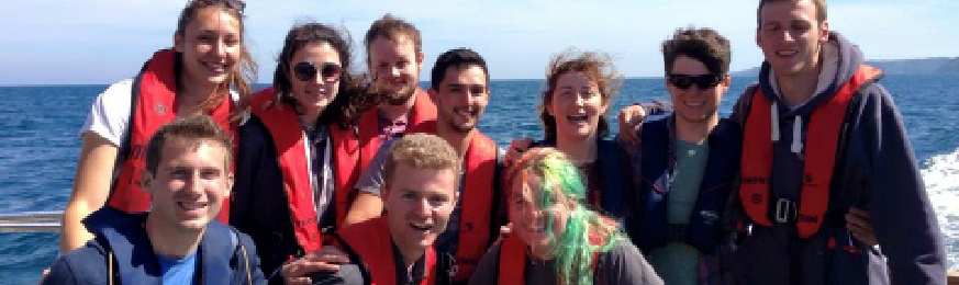
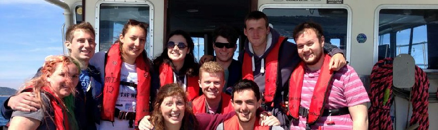
The research team consisted of 10 undergraduate and exchange students from the University of Southampton studying Marine Biology, Oceanography or Meteorology, click here for more information.
- Projects.exeter.ac.uk, (2015). Location. [online] Available at: https://projects.exeter.ac.uk/geomincentre/estuary/Main/loc.htm [Accessed 29 Jun. 2015].
- Destination-
cornwall.co.uk, (2015). The Fal Estuary and Area. [online]
Available at: http://www.destination-cornwall.co.uk/portfal.htm [Accessed 29 Jun. 2015]. - Jncc.defra.gov.uk, (2015). Fal and Helford -
Special Area of Conservation - SAC - Habitats Directive. [online]
Available at: http://jncc.defra.gov.uk/protectedsites/sacselection/sac.asp?EUCode=UK0013112 [Accessed 28 Jun. 2015]. - Deeble, M. and Stone, V. (1985). A port that could threaten marine life in England's Fal Estuary. Oryx, 19(02), p.74.
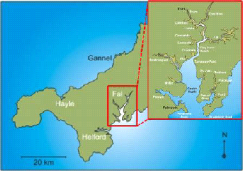
Figure 1. Location of the estuary on the south-
Figure 2. Showing the extent of the SAC that involves the Fal estuary
Contents