
Falmouth 2015 Group 10
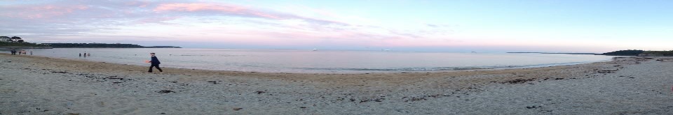
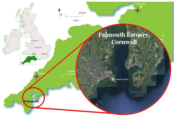
The Fal estuary is a drowned river valley, or ria, system located on the South coast of Cornwall that was formed in the Holocene at the end of the last glaciation. This ria system has six main tributaries including the Truro, Carnon and Kennal rivers and consists of subtidal and intertidal flats, and saltmarsh (1).
There is a long history of mining in the catchment area of the Fal estuary, especially in Restronguet Creek which drains the Carnon Valley, where much of the mining took place. As a result, very high concentrations of some metals have been recorded in the Carnon River and therefore the Fal estuary, which has led to some populations in the estuary to have increased levels in their systems, which would normally be fatal but these populations have developed increased tolerance and some physiological modifications instead (2).
The most recent contamination event occurred in Restronguet Creek in 1992 from the Wheal Jane mine which had been abandoned in 1991 and caused an uncontrolled release of acidic water heavy with metals and toxic substances including tributyl tin from antifouling paints causing the river to turn red and requiring extensive clean-up operations in order to detoxify the waters.
Aidan Starr- BSc Oceanography
Courtney Clemence- BSc Oceanography
David Allwright- BSc Oceanography
Elisabeth House- MSci Oceanography
Ewan Chaplin- MSci Marine Biology
Jago Staplehurst- MSci Marine Biology
Henry Ernst - MSci Marine Biology
Matt Parker- MSci Marine Biology
Shelley Ward- BSc Marine Biology with Oceanography


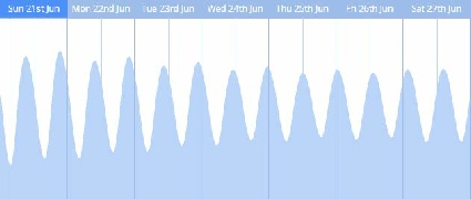
Tidal cycle for Falmouth for the two weeks commencing Sunday 21st June. Spring tides are the largest tidal height range, whilst neap tides are the smallest range. The tidal cycle played an important part in all of our findings.
Estuary
The Fal estuary is dominated by seawater input as indicated by the high salinity and uniform properties of the estuarine system. Due to the strong macrotidal forces and weaker river input the estuaries overall seem to be well-mixed, though stratification is apparent towards the head of the estuary. Nutrients in the estuary behave in a non-conservative manner indicative of several removal mechanisms. This is likely to be due mostly to biological uptake as phytoplankton samples show a large, diverse population, dominated by the siliceous diatom Chaetoceros. These phytoplankton provide ample support for a flourishing zooplankton community.
Offshore
In general, the more offshore stations showed an increase of chlorophyll with depth, symptomatic of a subsurface chlorophyll maximum, unlike the stations sampled near shore, possibly because of riverine nutrient replenishment. Largely chlorophyll and oxygen levels were lower in the more turbid near shore stations. Most stations showed a decrease in oxygen and nutrients with depth. However, moving offshore, surface nutrient levels were depleted, most likely due to biological uptake. The phytoplankton community structure changed moving offshore with Leptocylindrus becoming the more dominant group. The offshore zooplankton community was the most diverse, while the inshore communities were less diverse but hosted rarer groups including Mysidacea.
Pontoon
The water properties around the pontoon are mostly influenced by changing tides. Temperature in the area seems to peak just after low tide, and rapidly decreases as cooler marine waters move up the estuary with the incoming high tide, in contrast to salinity. Chlorophyll levels decrease as high tide approaches due to the increased volume of water. Turbidity in the area is affected by marine traffic, which causes turbidity spikes, as was measured when ferries docked at the pontoon.
Habitat Mapping
The habitats mapped included maerl beds, patchy reef and the edge of Carrick Roads channel but were mostly dominated by soft sediments. The mearl beds mostly consisted of two species of calcerous red algae and provide ample habitats and nurseries for other biota. Organisms identified included a substantial population of Turritella communis and some worm holes, thought to belong to Myxicola infundibulum..
With thanks to all of the staff and interns from the National Oceanography Centre, University of Southampton and Falmouth Marine School for all your help and encouragement during the two week field course.

The composition of the Fal is important for conservation as it includes a wide range of substrates including sandbanks, mudflats and saltmarshes which encompass a large variety of species, including Eelgrass Zostera marina beds and maerl beds. These communities are very rare and provide nursery grounds and habitats for many commercially important fish and invertebrate species, thus these areas have been classified as Special Areas of Conservation (SAC).
Click to enlarge

The views on this website are solely those of Group 10, and are in no way affiliated with the views of University of Southampton or the National Oceanography Centre.

1. Pirrie, D., Crame, J. A., Riding, J. B., Butcher, A. R., & Taylor, P. D. (1997). Miocene glaciomarine sedimentation in the northern Antarctic Peninsula region: the stratigraphy and sedimentology of the Hobbs Glacier Formation, James Ross Island. Geological Magazine, 134(06), 745-762.
2. Langstone, W. J., Chesman, B. S., Burt, G. R., Hawkins, S. J., Readman, J., & Worsfold, P. J. (2003). Site characterisation of the South West European marine sites: Chesil Beach and the Fleet cSAC, SPA. Peterborough, UK, Environment Agency & English Nature.
| Introduction |
| Metadata |
| Biological |
| Chemical |
| Physical |
| References |
| Introduction |
| Metadata |
| Biological |
| Chemical |
| Physical |
| References |
| Introduction |
| Metadata |
| YSI |
| Flowmeter |
| Chlorophyll a |
| Irradiance |
| References |
| Introduction |
| Metadata |
| Methods |
| Sidescan |
| Video Ground-Truthing |
| Poster |
| References |