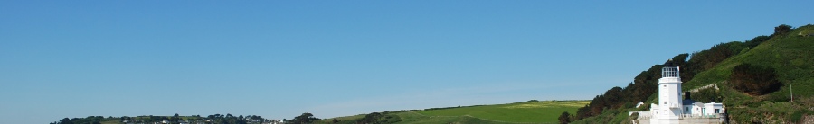

Falmouth is situated on the South Coast of England, in West Cornwall. It is the 3rd largest natural harbour in the world (1), a feature which has contributed to its rich maritime history. Falmouth was a commercially successful port, and a hub of fisheries, trade and also for the nearby heavy metal mining industy.
The Fal estuary stretches 18km inland from its entrance between Pendennis Point and St Anthony Head, all the way to Tresillian with a total area of 2482ha (2). There is a deep channel within the Estuary, known as Carrick Roads, which extends for 4 miles from Black Rock to Turnaware Point.
The Estuary is a ria (a drowned river valley) which was formed due to the rising of sea levels during the deglaciation of the last ice age. This means that there is a much lower input of freshwater than of saline water into the estuary, causing higher salinities, further up the estuary than would usually be expected.
The estuary is influenced by the macro tidal M2 dominated Carrick Roads, along with the meso tidal tributaries of the River Fal, River Helston, and River Truro. The estuary has a mean spring tidal range of 4.6m (chart datum).
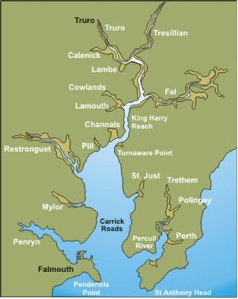
Map of Fal Estuary (4.)
The Fal estuary is a Special Area of Conservation (SAC) and is protected by a ‘Habitat Directive’ issued by the European Union. These are classifications issued to try to conserve areas which are home to rare and endangered species in order to protect biodiversity on a global scale. They implement a The Fal estuary has exposed mudflats up river, and the rocky coast is exposed to waves, characteristics common of a ria, and an ideal environment to support a wide range of habitats (3).
The estuary is home to maerl beds made up of 2 different species of maerl (Phymatolithon calcareum and Lithothamnion corallioides) which are along with rich areas of seagrass (Zostera). These areas act as breeding and nursery grounds for a wide range of species because they provide a sheltered environment in shallow water. However both seagrass and maerl are rare and both are badly affected by marine activity such as anchoring and dredging, and the recovery of damaged areas can take decades, as maerl grows at a rate of approximately 1mm a year. These are important species which the SAC classification and the Habitat Directive are hoping to protect. Maerl had been extracted from dredge oozes in the Fal since the 1600s and was used to produce agricultural fertiliser and soil buffers (4), and very little was known about the important contribution it makes to the marine environment. Extraction continued until 2005, and in 2009 the area was made a dedicated SAC.
One of the tributaries into the estuary is the Carnon River, and this river has a catchment that includes areas in which heavy metal mining was taking place until as late as 1991. This has led to increased inputs of heavy metals into the estuary such as Cu, Fe, Cd, As and Zn, and these metal can still be found in runoff which enters the estuary. Several centuries of this run off has led to increased concentrations of heavy metals in the estuary sediment (5).
References
(1) Cornwall Rivers Project, Geography, Fal and Tresillian, [Online], 2006.
Available: http://www.cornwallriversproject.org.uk/geography/fal.htm
Accessed 29/06/2014
(2) https://projects.exeter.ac.uk/geomincentre/estuary/Main/loc.htm
Accessed 29/06/2014
(3) Fal & Helford Special Area of Conservation Management Scheme. 2006. 1-
Available at:
Accessed 29/06/2014
(4) Hall-
(5) Somerfield, P.J., Gee, J.M. & Warwick, R.M. 1994. ‘Soft Sediment Meiofaunal Community
Structure In Relation To A Long-
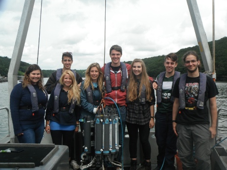
We are a group of undergraduate students studying Oceanography and Marine Biology at the University of Southampton, and between 23rd June and 4th July 2014 we started an investigation into the conditions present in the Fal estuary and the surrounding coastline. During our investigations we collected a range of Biological, Chemical and Physical data at different locations in and around the Estuary, and have processed that data, the results of which can be seen on this website. The purpose of this fieldcourse was to expand our understanding of important Oceanographic processes, and how lots of different aspects of the environment contribute to the habitats and conditions that we can observe. The fieldcourse has also been an opportunity for us to improve our understanding of a range of different sampling methods, and has given us vital practical experience in a range of conditions.
Figure 2: Group 4, From Left to right:
Elizabeth McLachlan -
Jonathan Cronk -
Olivia Watkins -
Emma Bolton -
Max Ambler -
Jessica Howard -
Sam Farmer -
Philip Leadbitter -