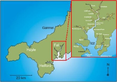
BACKGROUND TO THE FAL ESTUARY
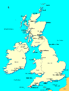
The Fal Estuary is located in Cornwall in South West England. It is the largest estuary
in the country that was formed, from a drowned river valley, as glaciers melted at
the end of the last ice age. There are 6 main tributaries that contribute to salinity
structure of this well mixed tidally dominated estuary, which has a 5m mesotidal
range.
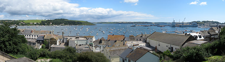
These physical factors make the estuary very important for trade, tourism and conservation.
The estuary is home to many different habitats and species which are protected by
Marine Special Areas of Conservation. For example, it is home to long lived and slow
growing maerl beds which can only grow in very specific conditions. This maerl has
been subjected to suction dredging. In addition, it is important for its fisheries
and oyster beds.
The estuary has been subject to pollution due to human activities. For example, the
Wheal Jane incident in 1992 which resulted in tailings from mining activities forming
iron oxides in Restronguet Creek. Furthermore, there are a number of sewerage outlets
along the length of the estuary as well as agricultural inputs which can have an
effect on nutrient levels. One of the consequences of this is blooms of Alexandrium
tamerense, which cause red tides.
AIMS
The aim of this field course is to carry out investigative fieldwork in the Fal Estuary
and surrounding areas over the period of two weeks between 23/06/2014 and 05/07/2014.
The data collected will be compiled from all 11 groups to gain an understanding of
the physical, chemical and biological processes. This will then allow us to suggest
how the system may work as a transition zone from freshwater to the coastal region.
This aim was achieved by undertaking multiple surveys within the estuary and offshore
to collect the necessary data.
GROUP 11
Chloe Bentley - Msci Marine Biology
Isabel Brown - Bsc Marine Biology with Oceanography
Tomas Hannam-Penfold - Bsc Oceanography with Physical Geography
Joanna Hawes - Msci Marine Biology
Alex Maydew - Bsc Marine Biology with Oceanography
Benjamen Paterson - Bsc Marine Biology with Oceanography
Emmelia Sweetland - Bsc Oceanography with Physical Geography
Hannah Taylor - Msci Marine Biology
Katie Welsh - Bsc Marine Biology with Oceanography
REFERENCES
1. James, R, (2014), ‘Background to the Fal estuarine system’ lecture, SOES2027.
2. Location of the Fal Estuary, [Online], n.d., Available: https://projects.exeter.ac.uk/geomincentre/estuary/Main/loc.htm,
[Last accessed: 4th July 2014].
Disclaimer - These views are of the students of group 11 only and do not reflect
the views and opinions of the National Oceanography Centre or the University of Southampton.
 PONTOON
GEOPHYSICS
ESTUARINE
OFFSHORE
Home
PONTOON
GEOPHYSICS
ESTUARINE
OFFSHORE
Home