University of Southampton Falmouth Field Course 2013 26th June -
A third year Oceanography and Marine Biology project conducted by students from the University of Southampton, investigating the physical, chemical and biological properties of the Fal estuary and the surrounding offshore areas.
The aim of this fieldwork is to understand the processes which occur in the transition zone between the coastal sea and the Fal estuary, to collect and interpret a time series measurement in the Fal Estuary, and investigate the substrate, infauna and epifauna of the Fal estuary through habitat mapping. To do this data was sampled and analysed using a wide range of techniques over a series of different sites. Use the navigation bar to view our results and findings.
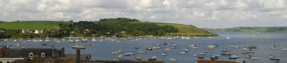
The Fal Estuary is located on the south coast of Cornwall, UK with an approximate length of 18.1 km. The mouth of the estuary has thick sandstone and mudstone beds (Hughes , 1999) as a result of the drowned river valley dating back to the last Ice Age (Stapleton et al. 1995). A considerable amount of silt is present in the estuary due to sediment deposition and significant anthropogenic influences such as discharge of mining waste (Hughes , 1999).
The Fal estuary is one of the largest estuarine systems in South West England, and as a result it is very important to tourism, conservation and industry development. There are six major tributaries that lead into Carrick Roads (Hughes 1999), the third largest natural harbour in the world, meaning the area is under pressure to be further industrialised (Tuck et al. 2011).
The estuary is generally macrotidal, where tides exhibit a mean spring tidal range of 4.6m, and a mean neap tidal range of 2.2m (UKHO, 2008). Towards Truro the estuary becomes mesotidal with a mean spring tide of 3.5 m (UKHO, 2008).
The Fal Estuary is a designated Special Area of Conservation (SAC) (Hall-
The group sampled through the water column in both the estuary using eulerian and
lagrangian measurements as well as offshore . The dominant wind direction is south-
Offshore measurements (26/06/2013)
The measured parameters included current velocity (m/s), temperature (˚C), salinity, chlorophyll (µg/L) and density (kg/m3). Measurements and samples were collected at four different sites using a CTD, ADCP, zooplankton nets, Niskin bottles, and a secchi disk. The locations of the measurements were selected by the group between Blackrock and a regularly sampled station by Masters students of the University of Southampton.
Offshore sample analysis (27/06/2013)
Collected offshore samples were analysed for phytoplankton abundance, zooplankton identification, nutrient concentrations (nitrate, phosphate, and silicate), and dissolved oxygen saturation (%).
Pontoon Time series measurement (28/06/2013)
Time series measurements, on the order of every half an hour, were taken at the Trelissick pontoon, Falmouth. These time series measurements included salinity, temperature, dissolved oxygen, pH, current velocity , current direction and light attenuation using a secchi disk and light meter.
Along the Fal estuary, using underwater video footage and side scan sonar, habitat maps were produced. Changes were observed in flora and fauna, substrate and suspended particle matter throughout the water column at locations along the river. Points of interest were identified from the side scan sonar and used to produce a scientific poster.
Physical, chemical and biological parameters were sampled at eight stations from the River Truro to the mouth of the Fal estuary. CTD, ADCP , and Niskin bottles were used to collect the relevant data. Samples were analysed in the same manner as the offshore sample analysis
Group Members
Oceanographers:
Sophia Ashby: MSci Oceanography
Calum Fox: MSci Oceanography
Will James: BSc Oceanography
Lucy Lintott: MSci Oceanography
Angelina Smilenova: MSci Oceanography
James Wilkie: Bsc Oceanography with Physical Geography
Marine Biologists:
Jack Harrington: MSci Marine Biology
Jamie Hudson: MSci Marine Biology
Bethan Jones: Bsc Marine Biology with Oceanography
Francesca Trotman: MSci Marine Biology
References
www.ukho.gov.uk, 2011, Date accessed: 1/7/2013
Hall-
Hughes, S. H. (1999). The ge ochemical and mineralogical record of the impact of
historical mining within estuarine sediments from the upper reaches of the Fal Estuary,
Cornwall, UK. International Association of Sedimentologists. 28, 161-
Langston, W. J., Chesman, B. S., Burt, G. R., Taylor, M., Covey, R., Cunningham,
N, Jonas, P., Hawkins, S. J. (2006). Characterisation of the European Marine Sites
in South West England: the Fal and Helford candidate Special Area of Conservation
(cSAC). In Marine Biodiversity (pp. 321-
Stapleton, C., Pethick, J. (1995) The Fal Estuary: Coastal Processes and Conservation. Report to English Nature, Institute of Estuarine and Coastal Studies, Hull.
Tuck, S., Dinwoodie, J., Knowles, H., Benhin, J. (2011). Assessing the environmental
impact of anchoring cruise liners in Falmouth Bay. Cruise Sector Challenges. 93-
Disclaimer
The views expressed on this website are those of Group 9 on the Falmouth 2013 field course. They are not the opinions of the University of Southampton or the National Oceanographic Center.
| Introduction |
| Methods |
| Results |
| Discussion |
| Physical |
| Chemical |
| Biological |
| Physical |
| Chemical |
| Biological |
| Introduction |
| Methods |
| Results |
| Discussion |
| Physical |
| Chemical |
| Biology |
| Physical |
| Chemical |
| Biology |