 Oceanographic Investigation of
Oceanographic Investigation of
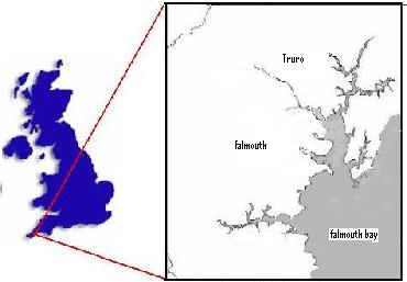
The Fal Estuary
Group 2 - July 2006
 Contents
Click on this link to view geophysics estuary survey data.
Click on this link to view Bill Conway estuary survey data.
Click on this link to view Callista offshore survey data
Click here to view Rib river survey data
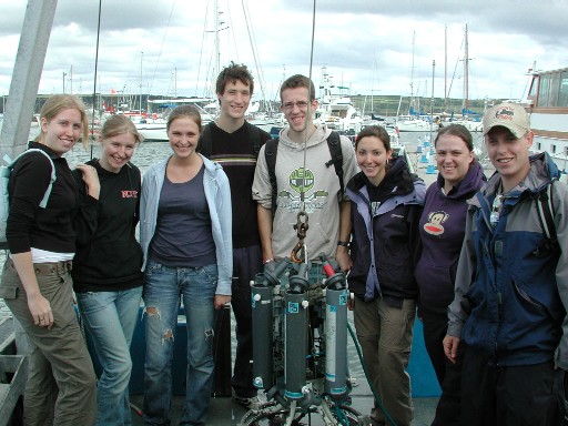
From Left to Right :- Rachel Hooke, Emma Preistland, Helen Griffiths, Alex Orbell, Stephen Parry, Elise Bromley, Sarah Taws, Ben King.
Attractive people dedicated to science in attractive locations.
Click here for more group pictures
We, as a group
have surveyed the very depths of the Fal Estuary from the head to the mouth.
Come rain or shine we have endeavoured to sample many different data types;
physical, geological, chemical and biological profiles of the area have been
taken in an attempt to quantify and rationalise the mysteries of the Fal
Estuary. Over a 14 day period and with the use of four vessels, freshwater
inputs and saltwater inputs have been monitored for nutrient and chlorophyll
content. Sediment boundaries have been mapped for varying types and species
distribution within these boundaries. Currents, temperature and salinity levels
have been analysed and beer has been drunk. We are group 2, the super team, and
we bring you:
"Answers
from the Fal"
The following website is aimed to express data collected from the various sources and give an informative account of the processes undertaken in collecting data and a comprehensive guide to the results collected and their analysis over a 14 day analysis of river, estuary and offshore processes that occur within the Fal estuary and its surrounding water courses.
Introduction to The Fal Estuary
Falmouth has long been considered a thriving port and has been involved with the import of bulk industrial material since as early as the 14th Century where it was a major importer of tin, granite and coal. Boat traffic has always been a major influence on the Fal estuary and in the modern era it is still used extensively by industry as a major port in the South of the country. There are large dock yards that are involved in bunkering and ship repair, bulk cargo handling and ship building. As private yachts become more popular in the public sector boat traffic on the estuary has increased greatly especially over the last twenty years, this large industrial increase and an increasing urban population in the area have resulted in some effects on the estuaries biological and chemical makeup.
An increase in pollution is evident, with a large sewage effluent on the seabed pumping processed sewage into the mouth of the estuary. From the excess boat traffic and ports in the area; hydrocarbon emissions have increased effecting the biology and chemistry of the water column, most notably in the sediments which are anoxic in many areas. As large industrial vessels navigate within the estuary on a daily basis, dredging occurs to prevent sedimentation of the channels. This dredging disturbs sediment zonation, increases erosion and damages sea bed biota.
The area is also a valuable scientific study ground with several important biological species that have been placed within an Special Area of Conservation (SAC). Maerl Beds, Zostera Beds and Slipper Limpet (Crepidula fornicata) Beds are all important constituents of this SAC area.
Mining in the area has caused heavy metals to leech into the estuary system which have inevitably reached the main estuaries body of water causing sediments to be high in heavy metals. Copper, Zinc, Precipitated Iron oxide, Lead, Silver and Arsenic are the major pollutants found in the area (Bryan and Gibbs, 1983). This may account for low biological activity in anoxic sediment grabs closer to the head of the Carrick Roads. However, according to the 1983 survey (Bryan and Gibbs) only heavy metal concentrations of 500μM are found within the Carrick Roads but amounts up to 2000μM found up river. Due to the vast majority of mines closing output has decreased drastically since the 1983 report however, groundwater and through flow from the abandoned mines still causes some leeching.
Anthropogenic activities have caused major chemical changes within the Fal system and some of these should be reflected in the results that have be attained by water the sampling and analysis that we have conducted.
Designed by group 2 © 2006